GNSS systems
Trimble DA2
Simply precise.
Powered by the Trimble® Catalyst™ GNSS positioning service, the DA2 receiver, combined with a Catalyst service subscription, delivers centimeter to sub-meter accuracy to location-enabled Android and iOS field apps and workflows.
Benefits and performance
Unmatched GNSS & RTK performance
The DA2 delivers Trimble precision and position quality to any location-enabled workflow, with increased accuracy and reliability near trees and buildings.

Highly portable, versatile and dynamic
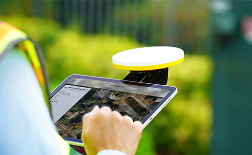
Work the way you want—pole-mounted or handheld—for flexibility in the field.

Centimeter
Full RTK precision
L1/L2/L5/MSS
Multi-constellation
Bluetooth
Connect to Android and iOS
Features and capabilities

Trimble ProPoint
Superior performance in challenging GNSS environments, including near and among trees and buildings.

Multi-band support
Supports all global and regional GNSS systems: GPS, GLONASS, Galileo, BeiDou, QZSS, NavIC/IRNSS, SBAS on L1/L2/L5 and MSS/L-Band.

Portable convenience
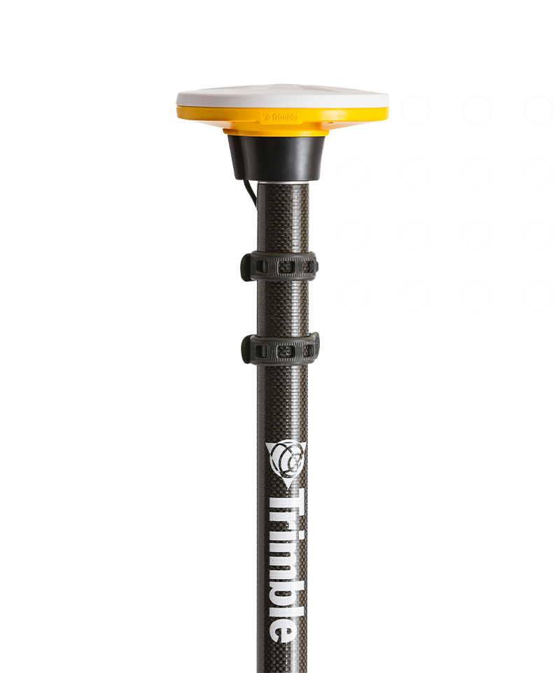
Our smallest and lightest RTK-capable GNSS receiver: at only 330 g (<12 oz), the unobtrusive but fully rugged DA2 is small enough to carry anywhere.

Flexible mounting options
Mount the DA2 on a survey pole or backpack, or utilize the Catalyst Handle accessory to turn your device into a superior quality handheld positioning system.

Industries and applications
The future of your work.
Trimble solutions facilitate high-quality, productive workflows and data exchange, driving value for a global, diverse user base.
Product summary
Trimble DA2
Designed for the Trimble Catalyst positioning service.
Product
Specifications
Scalable precision
RTK centimeter to sub-meter
Multi-frequency capable
L1/L2/L5/MSS
Satellites
All GNSS constellations supported
Connect to Android & iOS devices
Via Bluetooth to any location app
Small & lightweight
128 x 55 mm/330 g (<12 oz)
Ruggedness
MIL-STD-810G/IP65
GNSS systems
Trimble DA2
Get in touch for recommendations for the Trimble Geospatial hardware, software, and accessories needed to get your job done.
Where to buyWorks with...


Resources and knowledge


Watch what Trimble can do


Deepen your knowledge
Read customer success stories, ebooks, white papers and more.

Next steps
Our global network of Distribution Partners provides precision geospatial solutions, insight and support at a local level.