Office software
Trimble Inpho UASMaster
Photogrammetry-grade processing for unmanned aerial systems (UAS) and terrestrial close-range imagery.
The Trimble® Inpho® UASMaster software module combines ease of use with the full power of a photogrammetric workstation. Create powerful deliverables from images collected with UAS (Unmanned Aircraft Systems) aerial mapping and surveying systems.
Benefits and performance
Powerful workflows for superior results
Create a stable, reliable photogrammetric system with little manual input with computer-vision algorithms, GPS support and high-quality direct-georeferencing.


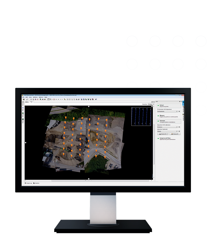
Robust processing engines with various quality control options
Includes intuitive guided workflows, robust processing engines, flexible camera calibration options and comprehensive quality assurance tools.
Features and capabilities

Providing powerful options
Process data from any type of UAS with frame-based cameras, with or without additional data, in different speeds and quality levels.

Delivering results you can trust
Achieve high-quality results based on powerful image matching and processing engines.

Works with Trimble Business Center
When using the Trimble Business Center Aerial Photogrammetry software package, utilize survey tools—with survey hardware—and GNSS post-processing options.

Everything you need
Includes advanced technology that's been customized to provide high-quality results from the special characteristics of UAS data in easy-to-understand, complete photogrammetry workflows.
Industries and applications
The future of your work.
Trimble solutions facilitate high-quality, productive workflows and data exchange, driving value for a global, diverse user base.
Product summary
Trimble Inpho UASMaster
UAS data processing and deliverables.
Product
Features
Robust image matching
Modern computer vision algorithms
High-quality deliverables
Strong dense matching engines
Photorealistic 3D meshes
For 3D visualization and streaming
Direct georeferencing
Synchronized with Applanix DG
Quality control
Quantitative and visual QC
Stereoscopic view
3D view for visualization
Office software
Trimble Inpho UASMaster
Get in touch for recommendations for the Trimble Geospatial hardware, software, and accessories needed to get your job done.
Request a demoWorks with...


Trimble Business Center Aerial Photogrammetry
Resources and knowledge


Watch what Trimble can do


Deepen your knowledge
Read customer success stories, ebooks, white papers and more.
Next steps
Our global network of Distribution Partners provides precision geospatial solutions, insight and support at a local level.