5 ways Trimble is making airports faster and safer
Airports are critical nodes in the global transportation network, requiring precision, safety, and efficiency in their construction and maintenance. Advanced technologies from Trimble® are playing a crucial role in meeting these demands. Here are five ways Trimble is revolutionizing airport construction, operations and maintenance.
1. Enhancing flight operations safety
Ensuring the safety of flight operations is a significant challenge in airport management. Trimble advanced technologies, such as the Trimble MX50 mobile mapping system and SX10 scanning total station, are pivotal in this regard. Proyform Global, a Madrid-based company, utilized these technologies to gather high-resolution geospatial data quickly and efficiently. Airports like Madrid, Barcelona, and Bilbao use this data to detect issues, such as pavement deformations on maintenance roads, airport roadways and taxiways.
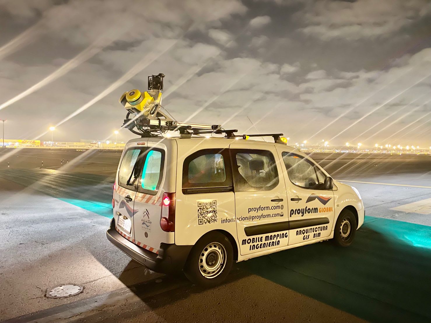
Proyform Global doing a pavement inspection project at an Aena network airport
The data also allows for conducting obstacle studies, performing luminance distribution studies and pinpointing the exact locations of aerial navigation aids. This comprehensive data integrates seamlessly into the airports’ existing GIS, providing a unified platform for analysis and decision-making.
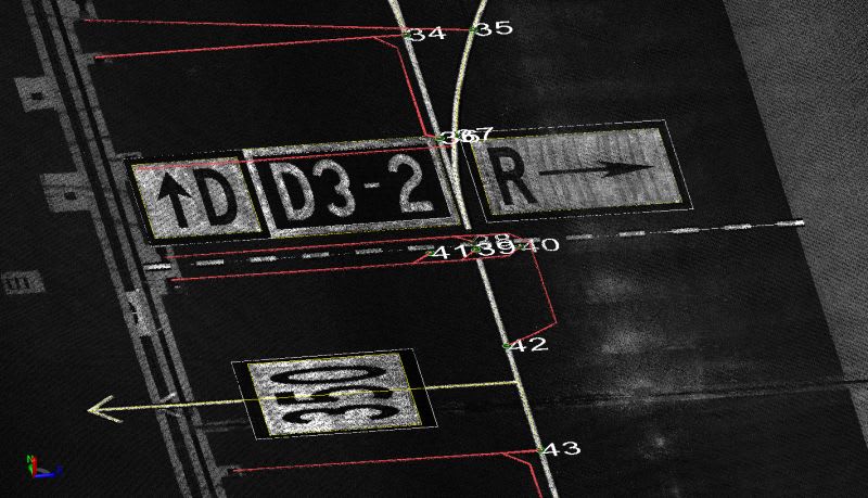
By leveraging Trimble mobile mapping and scanning technologies, airports can enhance operational safety, ensuring potential hazards are identified and addressed promptly. Read more of the case study here.
2. Precision in landing procedures
Accurate landing procedures are critical for safe and efficient airport operations. The UK Ministry of Defence, for example, requires precise positioning data for the navigation aids at each airfield to maintain accurate airfield maps. These maps are crucial for the maintenance of runways and keeping safety measures up-to-date.
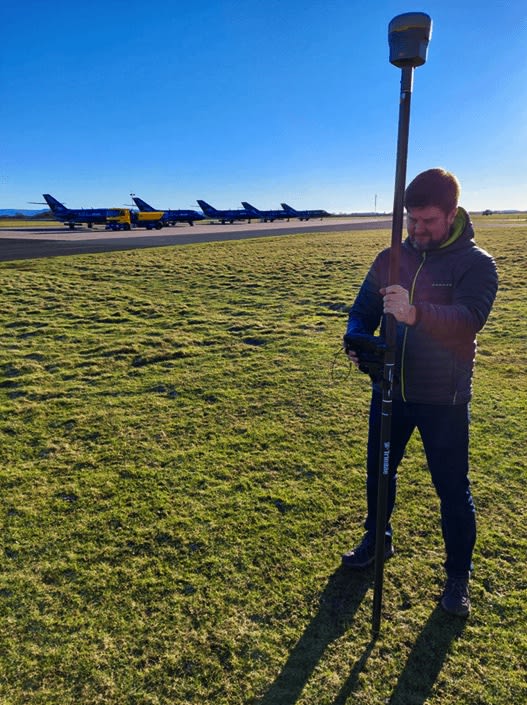
Thales Group, a global technology firm, was hired to survey UK airfields, using Trimble technology to improve the accuracy and efficiency of landing procedures. They employed the Trimble CenterPoint® RTX correction service, which provides reliable accuracy and consistently fast convergence times. This service saved 10 to 15 minutes per survey, achieving an accuracy of less than 2 centimeters.
The high level of accuracy provided by GNSS technology allows airports to optimize landing paths, reduce fuel consumption, minimize environmental impact and improve efficiency in landing procedures, resulting in reduced delays and an enhanced passenger experience.
3. Comprehensive asset lifecycle management
Digital technologies are enabling a new approach to designing, building, operating, and maintaining airports: airport asset lifecycle management. Airports generate more asset data than ever but often lack an efficient method to access, share, analyze, and report on this data.
Trimble Cityworks, now part of Trimble Unity Maintain, addresses this challenge by streamlining the inspection process. Airports, required to perform various FAA-mandated inspections daily, can now use Trimble Cityworks to ensure compliance with FAA 14 CFR Part 139 regulations. These inspections cover airfield assets such as lights, signs, pavement, navigational aids, and security items.
By digitizing the inspection process, the Trimble solution reduces labor hours, minimizes operating costs, and provides critical operational information. This allows airport authorities to gain insights from benchmarking data and better address airfield safety risks. The GIS-centric map interface, flexible search capabilities, and integrated mobile application make it easier for airports to log inspections and ensure compliance.
4. Seamless runway reconstruction
Runway construction is one of the most critical and complex tasks in airport infrastructure projects. In 2021, Luxembourg Airport's operators needed to complete the runway reprofile without disrupting daily scheduled take-offs and landings. They opted to build a new runway with different asphalt layers over the existing one.
Each night, a milling machine would rectify the profile of the runway track, while asphalt pavers would apply the necessary asphalt to reach the desired level. The use of Trimble 3D machine guidance ensured that the runway met exacting specifications, reducing the need for rework and accelerating project completion. This technology also enhanced safety by providing real-time data to machine operators, allowing them to make informed decisions immediately. Read the entire case study in English or German.
5. Mobile mapping for pre-construction
Before construction or renovations begin, mobile mapping can ensure projects go smoothly from the start. Strabag AG, one of Europe's largest construction companies, was hired for a €455-million Terminal 1 expansion project at Munich Airport in Germany. Their task was to provide a detailed as-built map of the existing space and its structures before demolition.
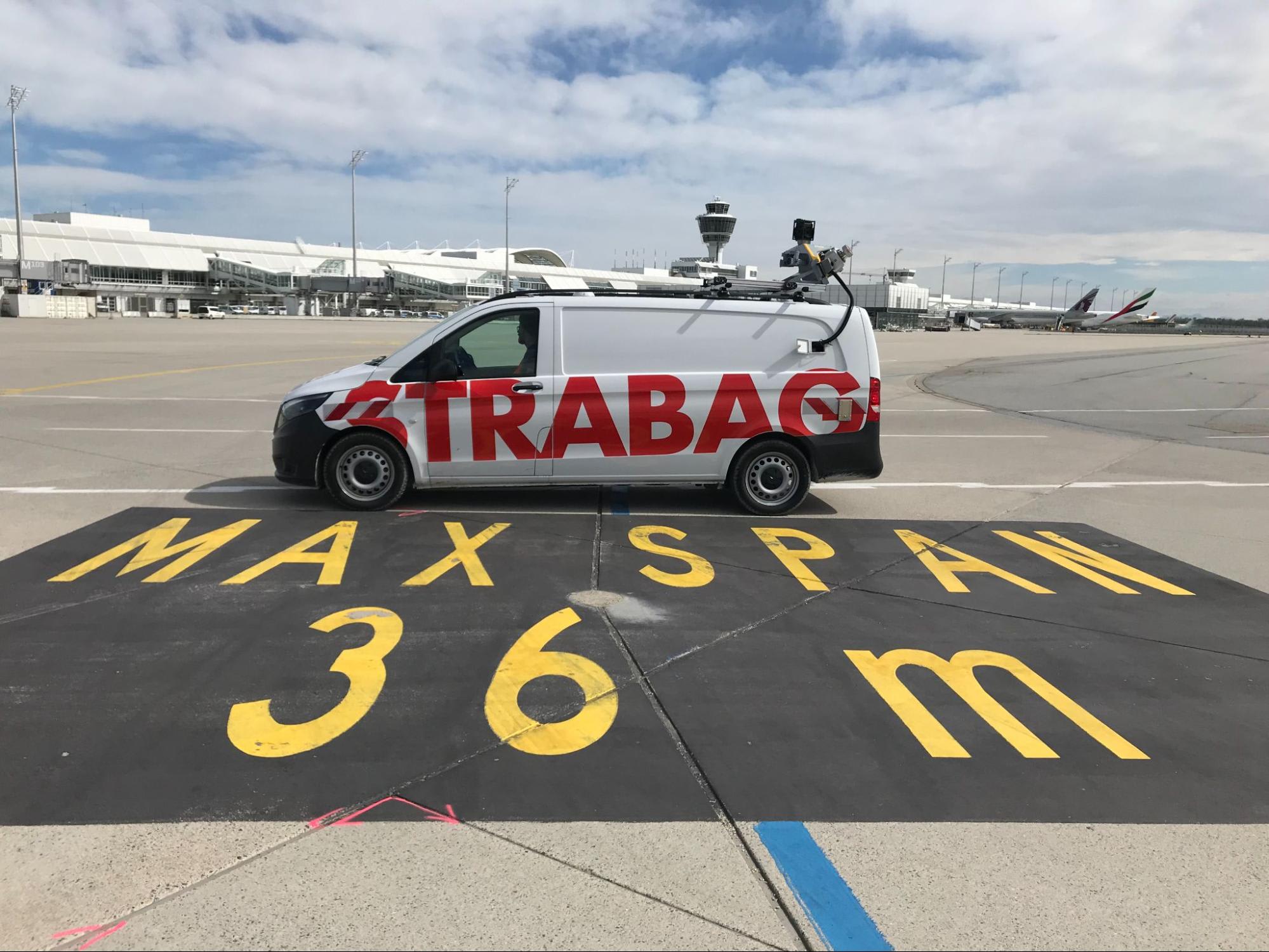
The team set out a network of ground control points across the 95,000 m² concrete apron and measured them with the SX10. They then scanned the entire area with the Trimble MX9 mobile mapping system, capturing all buildings, markings, lights, signage, and concrete seams. The resulting 3D model of the site clearly showed the terminal’s infrastructure, from the smallest concrete joint feature to the tallest light pole.
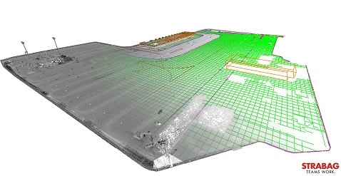
Conventional surveying of such a large site would have required several days of work, but mobile mapping collected the data in just one hour.
In another ambitious project, the construction of Kunming Changshui International Airport in China, contractor China Railway Construction Corporation (CRCC) faced the challenge of meeting tight deadlines while maintaining high-quality standards. To achieve this, CRCC turned to Trimble technology, incorporating solutions like the Trimble GCS900 grade control system and Trimble site positioning systems. These technologies enabled the team to automate machine operations, ensuring precise grading and excavation, significantly enhancing productivity and accuracy on the job site.
Trimble’s paving control and compaction control systems are also being used for the two new 4,000-meter-long runways for CBM paving and asphalt paving. Contractors can pave the base to design correctly, with an accuracy within 5 millimeters, saving on costly rework and reducing unexpected surface degradation. Read the entire case study here.
Advanced positioning is shaping tomorrow’s airports
From enhancing safety and precision to optimizing asset management and achieving significant cost and time savings, Trimble solutions are transforming the way airports are built and maintained. The real-world success stories from airports around the globe illustrate the tangible impact of Trimble technology, making it an indispensable tool for the aviation industry.