Laser scanning
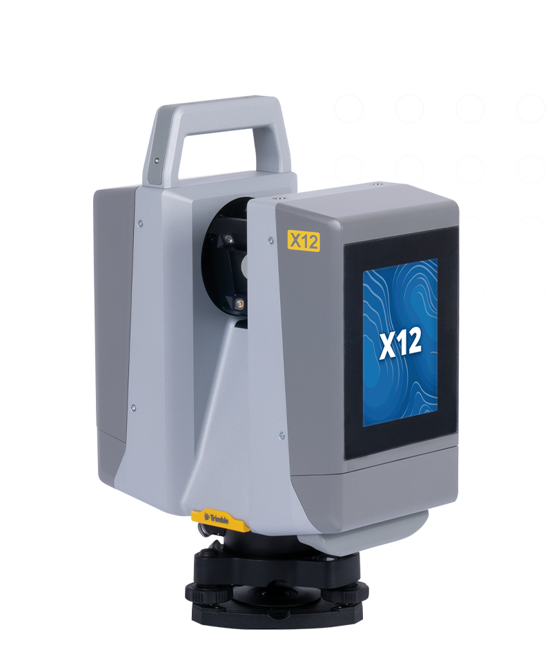
Trimble X12
Enhance your perspective.
The Trimble® X12 3D laser scanning system unites the best of both worlds with industry-leading hardware and ultra-efficient Trimble Perspective software for guaranteed peak performance.
Benefits and performance
Confidence that the job is done right
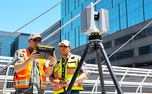
Top notch-performance equals confidence in precise data capture with the superior speed, accuracy and range of the X12.
Streamlined, accessible workflows
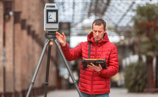
Trimble Perspective provides in-field registration to refine data in the field and enables peak performance back to the office thanks to seamless workflows.

Scan speed
Up to 2.187 million pts/sec
Scan range
0.3 m to 250 m working range 365 m ambiguity interval
Scan time
23 sec to 6 min 0.3 m to 250 m (working range)
Features and capabilities

Superior data quality
Exceptional accuracy, range and speed to quickly capture high density data with low range noise for the most complex applications.

Incomparable image acquisition
Sharp, parallax free images for flawless panoramas and scan colorization, plus LED spotlights to capture images even in complete darkness.

Intuitive & powerful
Trimble Perspective provides unparalleled clarity in the field with automatic scan registration and full 3D visibility to validate data in real time.

Complete scanning solution
With Trimble Business Center or RealWorks software, leverage advanced application specific tools for registration, scan analysis and design to enhance final deliverables.

Industries and applications
The future of your work.
Trimble solutions facilitate high-quality, productive workflows and data exchange, driving value for a global, diverse user base.
Product summary
Trimble X12
Accessible high-end 3D laser scanning system.
Product
Specifications
High resolution point clouds
Up to 2.187 million pts per second
Superior scan range
0.3 m to 365 m ambiguity interval
Quick, flexible point cloud capture
Full dome scans as fast as 23 seconds
Sharp, clean image acquisition
Colorized point clouds, parallax free
Ease of use
Intuitive Trimble Perspective workflows
LED spotlight
Easy capture in dark environments
| Skip comparison of 5 items | |||||||||||
| Scan Speed | Scan Range | Range Noise | 3D Point Accuracy | Scan Time | Imaging | Image Acquisition Time | Interface | Dual Axis Compensator | Ingress Protection | Laser Class | |
|---|---|---|---|---|---|---|---|---|---|---|---|
| Trimble X9 Core LTTrimble X9 Core LT | Up to 500 kHz | 0.6 m–40 m | < 1.5 mm @ 30 m on 80% albedo | 3.0 mm @20 m | 2-7 minutes | 3 coaxial, calibrated 10MP cameras | 1-2 min Standard (2-6min HDR) | WLAN via Trimble Perspective Windows tablet or Perspective Mobile from Apple or Android device | Accuracy <3", Range ±10° | IP55 | Laser class 1, eye safe in accordance with IEC EN60825-1 |
| Trimble X9 CoreTrimble X9 Core | Up to 500 kHz | 0.6 m–80 m | < 1.5 mm @ 30 m on 80% albedo | 3.0 mm @20 m | 2-7 minutes | 3 coaxial, calibrated 10MP cameras | 1-2 min Standard (2-6min HDR) | WLAN via Trimble Perspective Windows tablet or Perspective Mobile from Apple or Android device | Accuracy <3", Range ±10° | IP55 | Laser class 1, eye safe in accordance with IEC EN60825-1 |
| Trimble X9 PremiumTrimble X9 Premium | Up to 1000 kHz | 0.6 m–150 m | < 1.5 mm @ 30 m on 80% albedo | 3.0 mm @20 m | 1-6 minutes | 3 coaxial, calibrated 10MP cameras | 1-2 min Standard (2-6 min HDR) | WLAN via Trimble Perspective Windows tablet or Perspective Mobile from Apple or Android device | Accuracy <3", Range ±10° | IP55 | Laser class 1, eye safe in accordance with IEC EN60825-1 |
| Trimble X12Trimble X12 | Up to 2,187 kHz | 0.3 m–250 m; 365 m (Ambiguity Interval) | 0.25 mm @ 25 m (136 kHz) | 2.2 mm @20 m | 1-3 minutes | 80 MP panorama, paralax free image matching | 2-2.5 min (HDR) | Onboard touchscreen or Trimble Perspective on Windows tablet | Accuracy 14", Range ±0.5°, Resolution 0.001° | IP54 | Laser class 1, eye safe in accordance with IEC 60825-1 |
| Trimble SX12Trimble SX12 | 26.6 kHz | 0.9 m–600 m | 1.5 mm @ 50 m on 18-90% reflectivity | 2.5 mm @100 m std dev on sphere target position | 12 minutes | 3 calibrated cameras in telescope powered by Trimble VISION™ technology | 2.5 min Standard | WLAN via Trimble Access | Accuracy 0.5", Range ±5.4', Resolution 0.3" | IP55 | Pulsed laser 1550 nm; Laser class 1M |
Laser scanning
Trimble X12
Get in touch for recommendations for the Trimble Geospatial hardware, software, and accessories needed to get your job done.
Where to buyWorks with...


Resources and knowledge


Watch what Trimble can do


Deepen your knowledge
Read customer success stories, study ebooks and white papers, and more.
Next steps
Our global network of Distribution Partners provides precision geospatial solutions, insight and support at a local level.