


GNSS systems
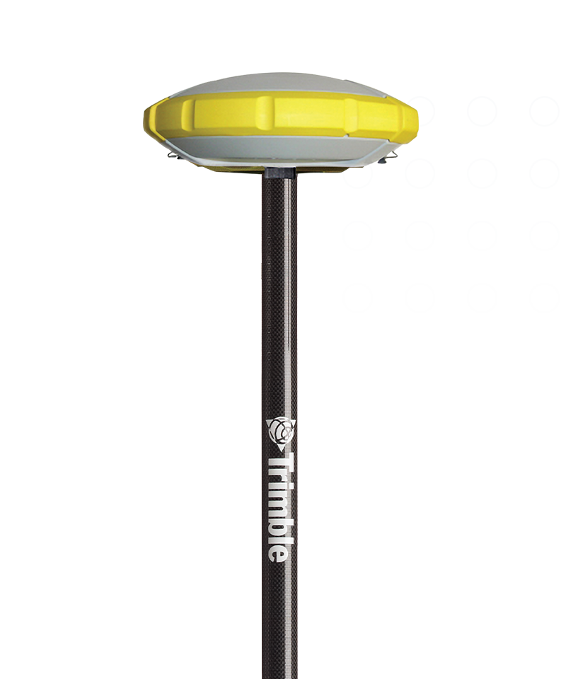
Trimble R4sLE
The alternative to a total station.
Trimble® R4sLE is a survey-grade GNSS solution purpose-built for public safety. Capture, collect and examine scenes quickly and easily with a no-compromise software-hardware solution made by reconstruction experts. Includes service, training and support.

Purpose-Built
Made for public safety
Rugged
Waterproof and impact resistant
Simple
Works seamlessly with Trimble Capture
Features and capabilities

Field-to-finish
With public safety-focused Trimble Forensics Capture software, GNSS mapping at the scene is straightforward, allowing you to clear the scene quickly.

More options
With the option for base rover, cellular RTK or Trimble RTX corrections, you have the flexibility you need, from a simple scene to the most complex of crash sites.

Uncompromising accuracy
Having your checkpoints several feet off is a thing of the past. The R4sLE is survey-grade with no compromises and no need for site calibrations.

Always ready
Waterproof, impact resistant and with a -40℉ to +149℉ temperature range, your instrument will continue performing in any environment you find yourself working.

Industries and applications
The future of your work.
Trimble facilitates high quality, productive workflows and data exchange, driving value for a global, diverse user base.
Product summary
Trimble R4sLE
Designed for forensics, by forensics experts.
Product
Features
Multiple connection options
RTK, Trimble RTX, Base-rover
High precision
8mm H / 15mm V precision
Rugged system
Waterproof and impact resistant
Seamless software integration
Collect and store data in Capture
Easy to setup
No need for a tripod
Work untethered
RTX and Base-rover to work offline
GNSS systems
Trimble R4sLE
Get in touch for recommendations for the Geospatial hardware, software, and accessories needed to get your job done.
Contact usWorks with...

Trimble Forensics Capture


Resources and knowledge


Inspiring perspectives

Watch what Trimble can do

Join us live or later
Want to learn more?
Contact Trimble Geospatial today.