Field software
Trimble Access
Designed to support the way surveyors work
A leading field software used by professional surveyors around the world, Trimble® Access™ software delivers functionality that supports efficiency, accuracy and ease of use with simplified workflows.
Benefits and performance
Intuitive design simplifies field work
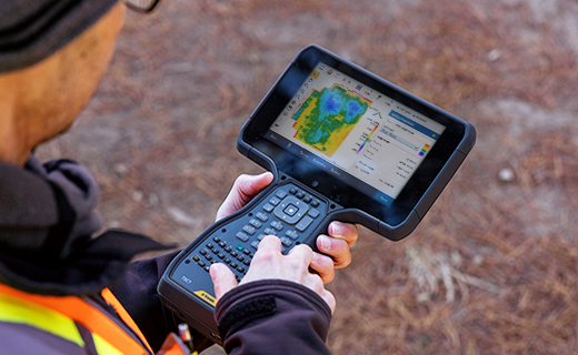
An optimized digital solution for survey workflows, enabling easier data collection, processing and analysis for field-to-office efficiency.
Powerful integration, convenient automation
Combine optical, scanning and GNSS job data sources. Automate tasks such as data synching and streamline the transfer of data between platforms.

Affordable
Lower upfront costs
Flexible
Built around your needs
Up-to-date
Benefit from enhancements
Features and capabilities

BIM file formats supported
View, Review and Stake from IFC models, storing BIM attributes with as-staked points.

Scheduled data syncs
Save time with AutoSync by automatically uploading job data to the cloud at a convenient time.

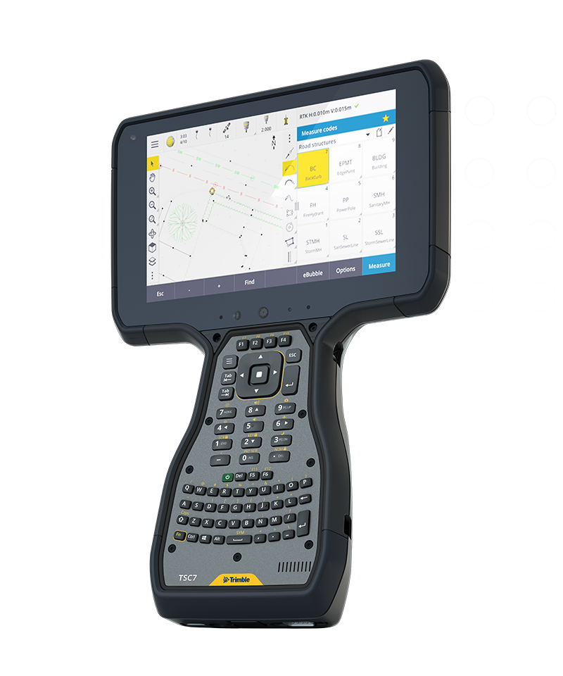
Linework & symbols shown in map
Feature coded linework and symbols shown on the map making features visible as you work.

Seamless field-to-office workflow
Control codes align with Trimble Business Center software for streamlined data management.

Industries and applications
The future of your work.
Trimble solutions facilitate high-quality, productive workflows and data exchange, driving value for a global, diverse user base.
Product summary
Trimble Access
Complete surveying solution for digital workflows.
Product
Features
Powerful COGO routines
Convenient one-tap feature coding
Integrate with BIM models
View & use IFC and TrimBIM files
Trimble Maps
Up-to-date background maps help identify key features near a survey mark
Horizontal tilt offset
Measure hard-to-reach locations
Underground utility locator
Locate buried assets
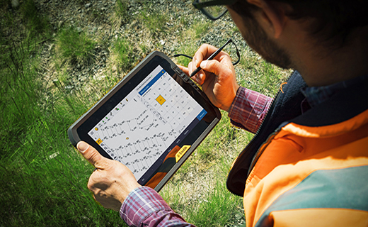
Split screen map & form layout
Interact with map & form fields
Trimble Access software has a range of specialized applications designed to make fieldwork easier.
Trimble Access
Roads
Finish roading jobs fast.
Trimble® Access™ Roads software defines, surveys and reports on roads with a simple, easy-to-use graphical interface specific to standard roading operations.
Trimble Access
Rail
Railway track specific software modules.
The Trimble® Access™ Rail software is a powerful suite of railway track specific software modules for track stakeout with total stations or GNSS receivers, and for track quality, track as-built and precise track installation purposes with track measurement trolley.
Trimble Access
Pipelines
Optimize pipeline surveys.
Use Trimble® Access™ Pipelines field software to collect pipe attribute data, record relationships between welds and pipes (joints), and when the pipeline is surveyed, link the join attributes to the measured welds.
Trimble Access
Tunnels
Finish tunneling jobs fast.
The Trimble® Access™ Tunnels software includes powerful tools to define, survey, and report your tunnel. The easy-to-use interface guides you through such tasks as marking areas of underbreak and overbreak, and positioning machinery.
Trimble Access
Monitoring
Streamlined monitoring configuration.
Trimble® Access™ Monitoring software provides a streamlined workflow for repeatable total station measurements common in deformation monitoring and precise control workflows.
Trimble Access
Mines
Finish mining jobs fast.
The Trimble® Access™ Mines field software includes powerful tools to survey and report on mine operations. The easy-to-use interface guides you through tasks such as auto staking lines to position a drilling rig within a mine.
Trimble Access
SDK
Build custom applications.
Trimble® Access™ SDK is a framework that allows third-party developers to add applications to Trimble Access field software. Create specialized and more customized applications and put them into use faster and more efficiently.
Field software
Trimble Access
Get in touch for recommendations for the Trimble Geospatial hardware, software, and accessories needed to get your job done.
Where to buyWorks with...


Trimble SX12
High-accuracy total station with high-precision scanning capabilities.


Resources and knowledge


Watch what Trimble can do

Join us live or later
Next steps
Our global network of Distribution Partners provides precision geospatial solutions, insight and support at a local level.