Office software
Trimble eCognition
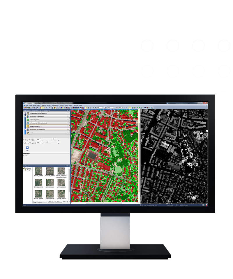
Transform data into information.
Save time and streamline your earth observation analysis with Trimble eCognition® software on desktop or in the cloud. Automate data interpretation by designing your own feature extraction and change detection solutions.
Benefits
Development platform
Fuse multiple geospatial data types, including spectral raster, 3D point cloud and thematic GIS layers, to customize analytics and create tailored applications.


Better organization, better interpretation
Improve, accelerate and automate the interpretation of geospatial data to transform geo-data into geo-information.
Features and capabilities

Customized rulesets

Quality and robustness

Extracting information

Scaled processing

Industries and applications
The future of your work.
Trimble solutions facilitate high-quality, productive workflows and data exchange, driving value for a global, diverse user base.
Product summary
Trimble eCognition
Streamline earth observation analysis.
Product
Features
Transform
Geo-data into geo-information
Data fusion
Fuse multiple geospatial data types
Customized rulesets
Create analytics and applications
OBIA & AI technology
High quality, robust automation
Scaled processing
Reduce data processing time
Extract information
Valuable information and analytics
Office software
Trimble eCognition
Get in touch for recommendations for the Trimble Geospatial hardware, software, and accessories needed to get your job done.
Where to buyWorks with...


Resources and knowledge


Watch what Trimble can do


Deepen your knowledge
Read customer success stories, study ebooks and white papers, and more.
Next steps
Our global network of Distribution Partners provides precision geospatial solutions, insight and support at a local level.