GNSS systems
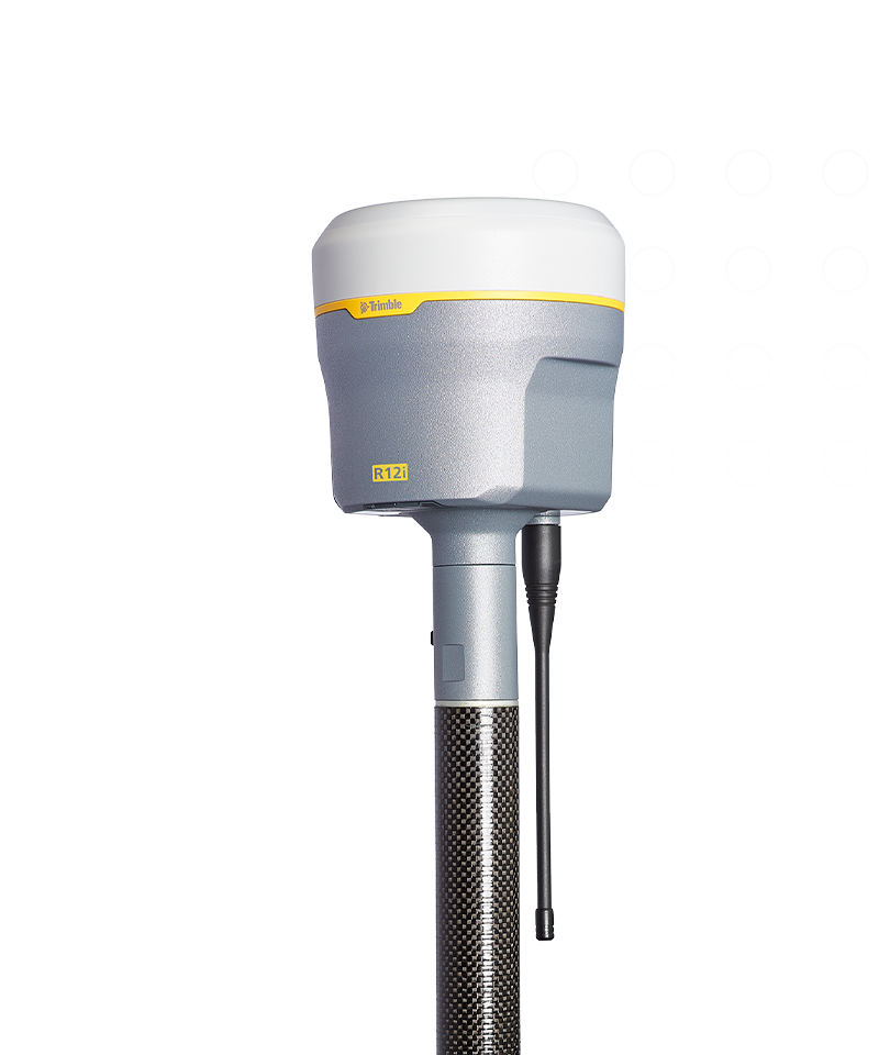
Trimble R12i
A new angle of productivity.
The Trimble® R12i GNSS system delivers unmatched GNSS performance and accuracy to boost the productivity of land surveyors like never before. Thanks to the advanced capabilities of the R12i, get more done without being level, faster.
Benefits and performance
Unmatched GNSS performance, speed & accuracy
Boost your productivity with measurably better performance in challenging urban and rural environments, near tree canopy or tall buildings.


Productivity from a whole new angle
Robust IMU-based tilt compensation lets you forget about leveling the pole, enabling you to get into tight places and get more done, faster than you thought possible.

8 mm H/15 mm V
Real-time kinematic precision
RTK + 3mm + 0.15mm/° tilt
TIP positioning performance
2 cm H/3 cm V
CenterPoint RTX precision
Features and capabilities

Trimble ProPoint

Trimble TIP

Trimble CenterPoint RTX

Trimble xFill

Industries and applications
The future of your work.
Trimble solutions facilitate high-quality, productive workflows and data exchange, driving value for a global, diverse user base.
Product summary
Trimble R12i
Unmatched GNSS performance to elevate survey productivity.
Product
Specifications
Real-time kinematic
8 mm H/15 mm V
TIP positioning performance
RTK + 3mm + 0.15mm/° tilt
CenterPoint RTX
2 cm H/3 cm V
Wideband UHF radio
Up to 2 Watt Tx
Lightweight
1.12 kg
Compact
11.9 cm x 13.6 cm
| Max. Precision | Channels | Antenna | UHF Radio | RTX Compatible | xFill | Memory | Cellular | Satellites | Additional Features | |
|---|---|---|---|---|---|---|---|---|---|---|
| Trimble R980Trimble R980 | 8 mm H/15 mm V | 672 | Integrated | Receive & transmit 450/900 MHz | Yes | Yes | 9 GB | 4G | GPS, GLONASS, Galileo, BeiDou, NavIC, QZSS, SBAS | ProPoint, TIP Tilt Compensation |
| Trimble R12iTrimble R12i | 8 mm H/15 mm V | 672 | Integrated | Receive & transmit 450 MHz | Yes | Yes | 6 GB | 3.5G | GPS, GLONASS, Galileo, BeiDou, NavIC, QZSS, SBAS | ProPoint, TIP Tilt Compensation |
| Trimble R780Trimble R780 | 8 mm H/15 mm V | 672 | Integrated | Receive & transmit 450/900 MHz | Yes | Yes | 9 GB | External | GPS, GLONASS, Galileo, BeiDou, NavIC, QZSS, SBAS | ProPoint, TIP Tilt Compensation |
| Trimble R580Trimble R580 | 10 mm H/20 mm V | 336 | Integrated | Receive 450 MHz | Yes | Yes | 256 MB | External | GPS, GLONASS, Galileo, BeiDou, SBAS, QZSS | ProPoint |
GNSS systems
Trimble R12i
Get in touch for recommendations for the Trimble Geospatial hardware, software, and accessories needed to get your job done.
Request a demoWorks with...

Trimble TSC510
Seamless connectivity, outstanding power and exceptional durability.


Resources and knowledge


Watch what Trimble can do


Deepen your knowledge
Read customer success stories, ebooks, white papers and more.

Next steps
Our global network of Distribution Partners provides precision geospatial solutions, insight and support at a local level.