GNSS systems
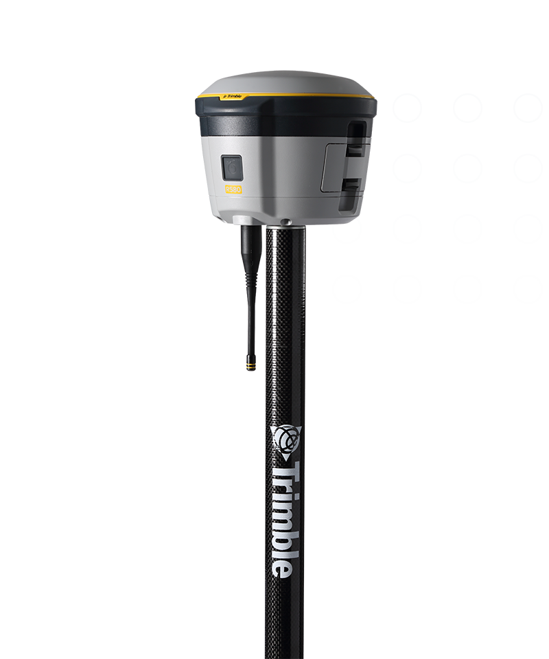
Trimble R580
Proven, reliable positioning
Depend on the Trimble® R580 GNSS system to keep you working with survey precision. Powered by the industry-leading Trimble ProPoint® GNSS engine, this everyday integrated receiver delivers greater productivity and reliable accuracy in more places.
Benefits and performance
Productivity maximized
The Trimble R580 harnesses Trimble ProPoint technology so you can work with precision in difficult places, boosting field work productivity like never before.


Trimble dependability
With proven technology to guard against anti-spoofing and multipath issues, the dependable R580 provides confidence for every measurement and point you capture.

10 mm H/20 mm V
RTK precision
2 cm H/3 cm V
CenterPoint RTX precision
IP65/MIL-STD
Ruggedness
Features and capabilities

Trimble ProPoint
Industry-leading performance in challenging GNSS environments, including near and among trees and buildings.

Trimble Maxwell 7
Enables fast processing, anti-spoofing capability, and the ability to track all current and new constellations for survey-precision positions in more places.

Trimble EVEREST Plus
Maintain the quality and integrity of your work with Trimble EVEREST™ Plus, which identifies and removes unwanted multipath signals.

Trimble CenterPoint RTX
Use the Trimble CenterPoint® RTX corrections service for real-time corrections via satellite or internet without requiring a local base station or VRS network.

Industries and applications
The future of your work.
Trimble solutions facilitate high-quality, productive workflows and data exchange, driving value for a global, diverse user base.
Product summary
Trimble R580
Access to professional-grade positioning accuracy.
Product
Specifications
10 mm H/20 mm V
Maximum precision
2 cm H/3 cm V
CenterPoint RTX precision
Quick setup
One-button start-up and cable-free
450 MHz
UHF radio (receive only)
IP65/MIL-STD
Ruggedness
iOS, Android, Windows 10
Platform support
| Max. Precision | Channels | Antenna | UHF Radio | RTX Compatible | xFill | Memory | Cellular | Satellites | Additional Features | |
|---|---|---|---|---|---|---|---|---|---|---|
| Trimble R980Trimble R980 | 8 mm H/15 mm V | 672 | Integrated | Receive & transmit 450/900 MHz | Yes | Yes | 9 GB | 4G | GPS, GLONASS, Galileo, BeiDou, NavIC, QZSS, SBAS | ProPoint, TIP Tilt Compensation |
| Trimble R12iTrimble R12i | 8 mm H/15 mm V | 672 | Integrated | Receive & transmit 450 MHz | Yes | Yes | 6 GB | 3.5G | GPS, GLONASS, Galileo, BeiDou, NavIC, QZSS, SBAS | ProPoint, TIP Tilt Compensation |
| Trimble R780Trimble R780 | 8 mm H/15 mm V | 672 | Integrated | Receive & transmit 450/900 MHz | Yes | Yes | 9 GB | External | GPS, GLONASS, Galileo, BeiDou, NavIC, QZSS, SBAS | ProPoint, TIP Tilt Compensation |
| Trimble R580Trimble R580 | 10 mm H/20 mm V | 336 | Integrated | Receive 450 MHz | Yes | Yes | 256 MB | External | GPS, GLONASS, Galileo, BeiDou, SBAS, QZSS | ProPoint |
GNSS systems
Trimble R580
Get in touch for recommendations for the Trimble Geospatial hardware, software, and accessories needed to get your job done.
Request a demoWorks with...

Trimble TSC510
Seamless connectivity, outstanding power and exceptional durability.


Resources and knowledge


Watch what Trimble can do


Deepen your knowledge
Read customer success stories, ebooks, white papers and more.
Next steps
Our global network of Distribution Partners provides precision geospatial solutions, insight and support at a local level.