Office software
Trimble Inpho
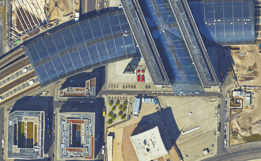
Advanced aerial photogrammetry.
With over 40 years as a pioneering photogrammetry solution, the Trimble® Inpho® software suite provides streamlined workflows for any aerial imagery project to generate high-quality products like dense point clouds, true orthophotos and 3D meshes.

Benefits and performance
Empowered engines for any camera system
With the robust image matching and camera calibration, Inpho supports any single camera or multi-camera system for professional photogrammetry.

Comprehensive workflow for any application
Level up your digital twins with the streamlined and modular products in the Inpho software suite for city modeling, rural or topographic mapping for any project size.
Features and capabilities

For any aerial imagery

Comprehensive evaluation tools

Product options available

Distributed processing

Industries and applications
The future of your work.
Trimble solutions facilitate high-quality, productive workflows and data exchange, driving value for a global, diverse user base.
Product summary
Trimble Inpho
An advanced photogrammetry solution.
Product
Features
Image capturing
Designed for any camera system
Imagery type
Any aerial frame digital imagery
Flexible, streamlined workflow
Modular products for any application
Quality analysis
Interactive QA tools and reports
Editing tools
Point cloud editing capabilities
Data integration
Combine image and LiDAR data
The Trimble Inpho software suite has a range of streamlined and modular products for any application.
Trimble Inpho
MATCH-AT
Large format aerial triangulation, manage complex imagery.
Empower your production line with Trimble Inpho MATCH-AT, the market-leading strong aerial triangulation and camera calibration engine software that evaluates the accuracy of your sensors and improves project outcomes with comprehensive reporting and detailed QA/QC tools.
Trimble Inpho
MATCH-3DX and MATCH-T
City modeling & rural mapping, dense point cloud generation.
Dense point clouds and meshes from high-overlap imagery can be generated by MATCH-3DX to achieve high-quality photo-realistic representation of large area mapping. Dense point clouds can be also generated for rural mapping with low overlap imagery by MATCH-T.
Trimble Inpho
MATCH-3DX, OrthoMaster, OrthoVista
True-orthophoto or classical orthophoto generation.
In addition to the generation of high-density point clouds, MATCH-3DX provides true-orthophotos in a seamless workflow for city mapping. Rectify images in rural mapping with low overlap imagery using OrthoMaster, and generate large orthomosaics with OrthoVista.
Trimble Inpho
DTMaster Stereo and SCOP++
Manual and automatic editing of point clouds.
Edit your image-based or LiDAR-based point clouds to improve the quality of your data if needed using DTMaster Stereo. For large-scale and topographic mapping, SCOP++ provides powerful tools for interpolation, filtering and analysis purposes.
Trimble Inpho
UASMaster
Full photogrammetry software, close-range & UAV applications.
Based on Trimble Inpho technology, UASMaster enables a full workflow, including image matching, tie point extraction, dense point cloud generation, 3D meshes and orthophotos for small- and medium-scale projects.
Office software
Trimble Inpho
Get in touch for recommendations for the Trimble Geospatial hardware, software, and accessories needed to get your job done.
Where to buy


Trimble Business Center Aerial Photogrammetry
Resources and knowledge


Watch what Trimble can do


Deepen your knowledge
Read customer success stories, study ebooks and white papers, and more.
Next steps
Our global network of Distribution Partners provides precision geospatial solutions, insight and support at a local level.