When Marco Graf and Fadri Jecklin, two geomatics specialists from InfraDigital, were approached with a proposal to install solar panels on a steep, snowy mountainside in Switzerland, they were intrigued. What began as a small proof-of-concept has transformed into a pioneering project to install 5,700 solar panel tables across 330,000 square meters of Alpine terrain.
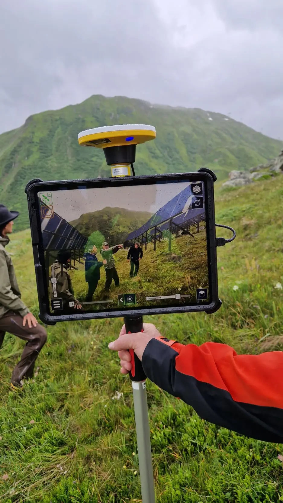
On-site visit with SiteVision to discuss environmental topics, speak with alpine farmers and local residents. Courtesy of ZENDRA AG.
The project, part of Switzerland's ambitious renewable energy initiative Solar Express, is under pressure to show results. The goal is to boost domestic winter energy production and help close the seasonal electricity gap. For Graf and Jecklin, the work is more than a professional achievement, it's a contribution to a sustainable future. "I think solar energy and all renewables are very important," Graf said. "It's especially interesting that we started on a green field. There were no existing systems. We had the opportunity to develop all-digital processes from the beginning."
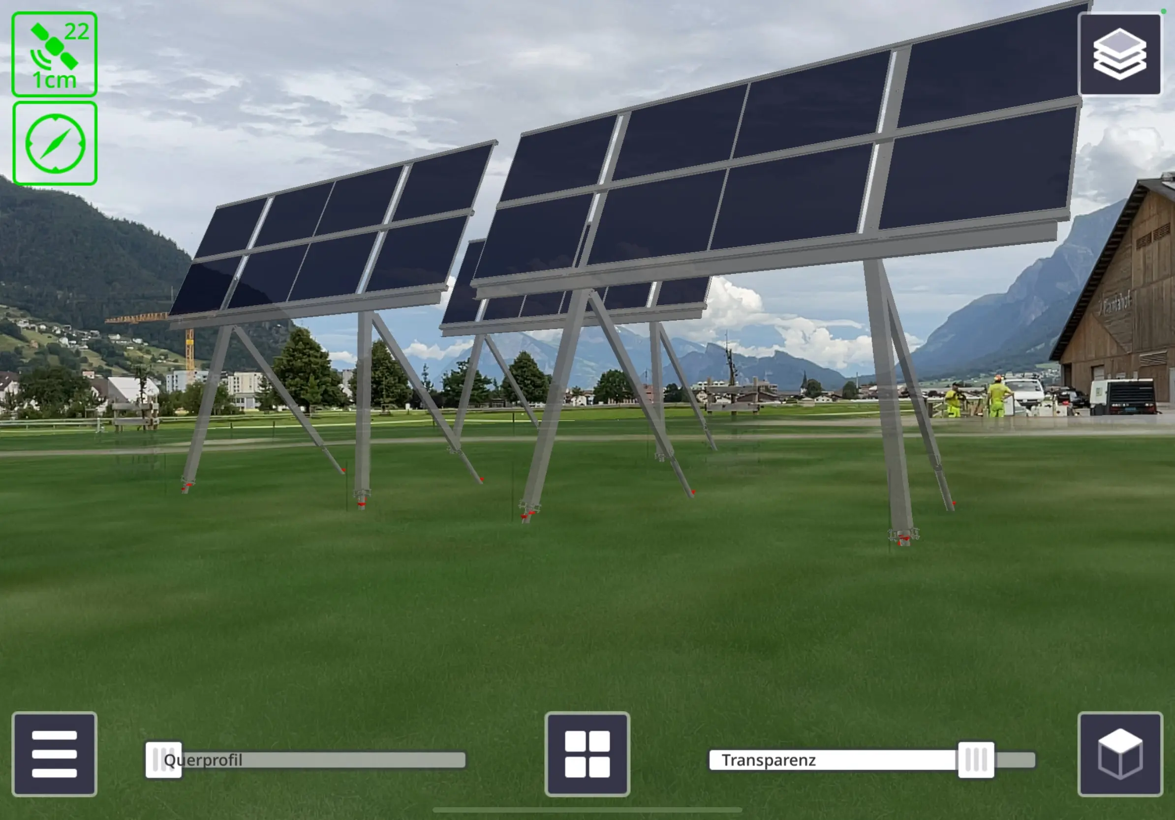
SiteVision image of the test plant at “Plantahof.” There, the interaction of the grazing animals (cows, goats, sheeps) was tested and studied. Courtesy of ZENDRA AG.
A mountain of challenges
The team quickly discovered why this wasn't just another solar installation. At 7,200 feet, the project faces unique challenges, including steep terrain, heavy snow, severe winds and a short, six-month construction window. The harsh environment dramatically complicates the installation itself, with each of the massive solar tables requiring custom leg lengths to adapt to the mountain's contours. Perhaps most critically, the team needed to build community support. "Without public acceptance this project would fail, and future projects will be in jeopardy without success right now," Graf noted. "We needed to show them how we addressed their concerns and minimized disruptions on the mountain."
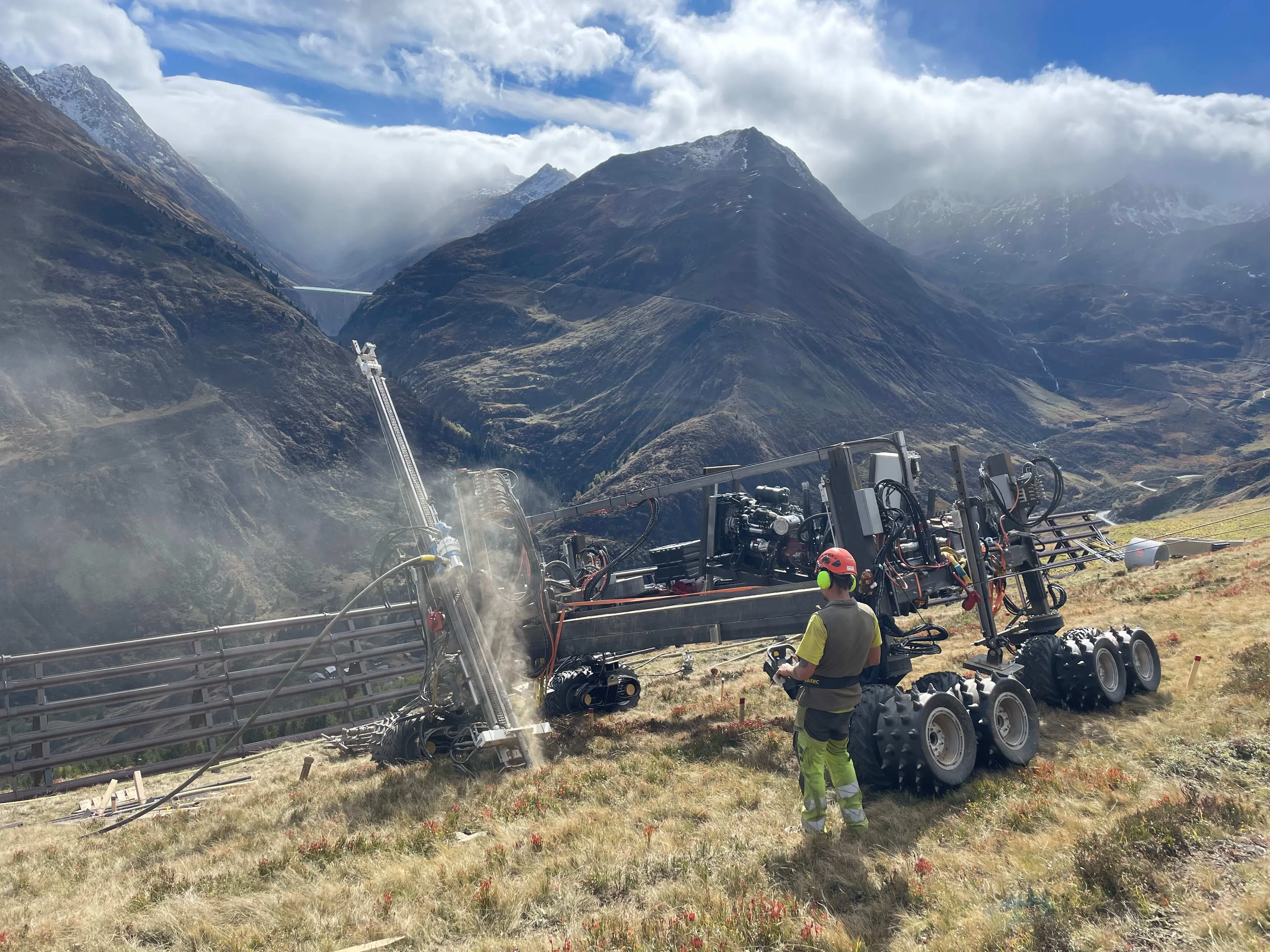
Prototype of a drilling system specially developed for alpine solar installations, called “Muntaniala” ("marmot" in Rhaeto-Romanic local language. Courtesy of CrestaGeo AG.
The solution was a digital-first strategy. The team created a comprehensive digital twin of the entire project, compiling data from aerial imagery and laser scanning into a central database. This digital foundation became the primary source of information for all stakeholders.
Public on board
To overcome community concerns, the team used Trimble® SiteVision®, an augmented reality tool that allowed them to load the digital model onto an iPad and overlay it on the actual terrain. This let landowners and environmental groups see precisely what the installation would look like from any vantage point. "In the early project phases, we displayed the digital model of the proposed site to transform abstract concerns into concrete understanding," Jecklin said. "This was really important for public acceptance of the plan."
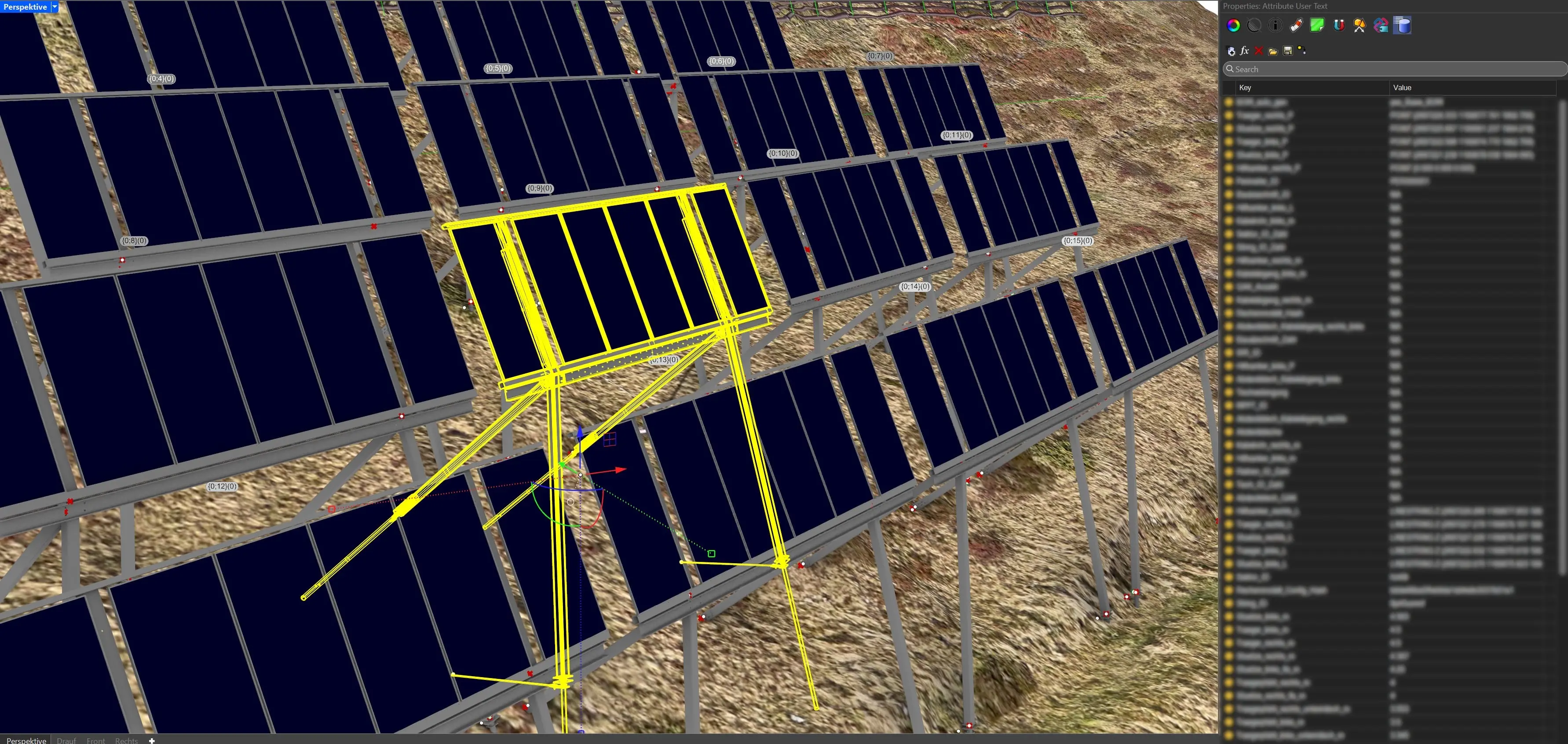
Tables are placed in Rhinoceros3D, with a Python-Script inside Grasshopper. The result is the 3D models of the tables, but also a lot of attributes attached to each table (position, orientation, production data, stakeout data etc.). Courtesy of ZENDRA AG.
The transparency worked. The local population voted to support the project and with approvals secured, construction began. The digital twin continues to serve as the project's backbone, ensuring that the industrial-scale production of custom parts is precise. "We have to be sure when the helicopter delivers the table it will fit, so we don't waste time," Graf said. Upon completion in 2028, the 5,700 solar panels will generate power for 6,500 homes, helping Switzerland achieve its ambitious goal of net-zero transmissions by 2050.
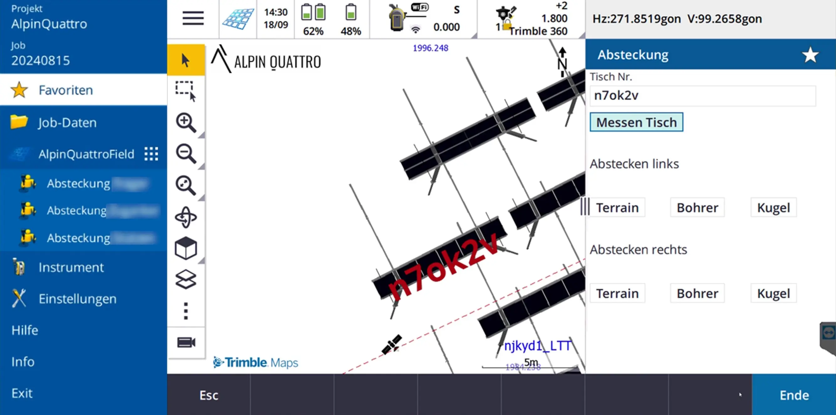
App specifically for the purpose of staking out and measuring the solar tables was developed, based on Trimble Access. Courtesy of ZENDRA AG.
Products used:
Trimble Connect® cloud software
Trimble Access™ field software and Trimble Access SDK
Trimble SiteVision AR
Trimble Groundworks machine control system
Trimble Business Center office software
Trimble S8 total station
Trimble R12i GNSS receiver
Read the published article here.


