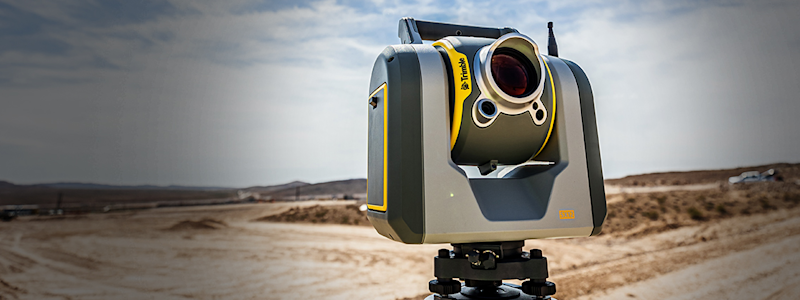
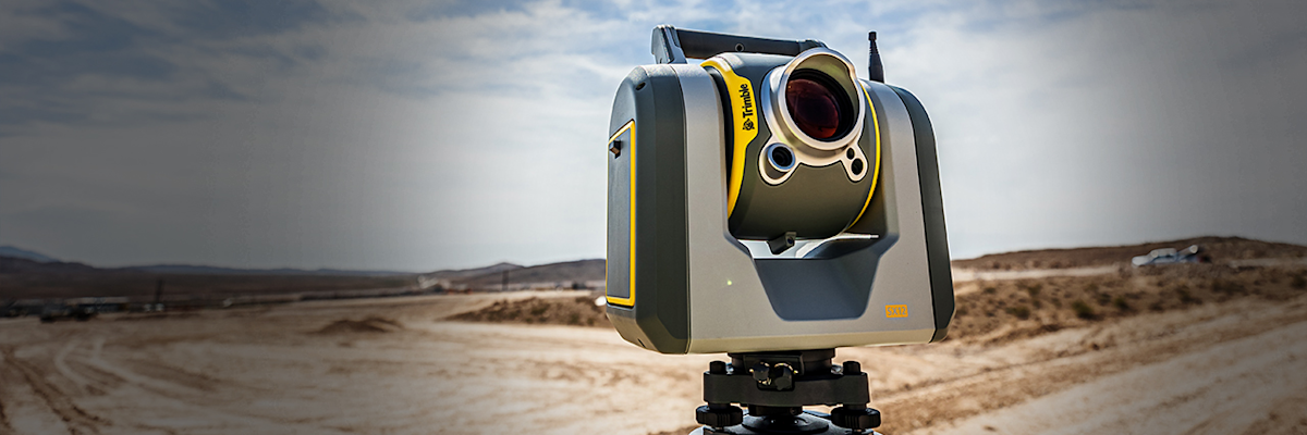
GNSS and total stations are both widely used for precise positioning in surveying and construction, but they arrive at a position in very different ways. A GNSS receiver calculates its location from satellite signals. A total station measures angles and distances optically from a known point on the ground.
That difference determines where each technology works best and which site conditions affect its performance.
What is GNSS?
GNSS, or Global Navigation Satellite System, is the general term for satellite constellations that provide positioning, navigation and timing data. GPS, operated by the United States, is the best-known example. Other global systems include Europe's Galileo, China's BeiDou and Russia's GLONASS. Regional systems such as Japan’s QZSS and India’s NavIC improve satellite availability over their parts of the world.
A GNSS receiver calculates its position from the signals those satellites transmit. Without corrections, standalone positioning is generally accurate to within a few meters in open sky, and errors can reach 10 meters or more near buildings or trees. Many surveying and construction applications require centimeter-level accuracy. Professional receivers can use real-time kinematic (RTK) corrections to achieve centimeter-level positioning. Those corrections can come by UHF radio from a nearby base station or over a cellular connection from a network of reference stations. Trimble helped pioneer RTK and introduced one of the first commercial RTK receivers in the early 1990s.
Mobility is one of GNSS's biggest advantages. A surveyor or construction professional can move across a jobsite and record positions without maintaining line of sight to another instrument on the ground. That makes GNSS especially efficient on large, open sites where crews need to collect points or stake out designs over long distances. It is also the positioning source for many machine control systems that guide construction equipment.
The main limitation is that the receiver needs a reasonably clear view of the sky. Buildings and tree canopy can block or reflect satellite signals, which makes GNSS harder to rely on in some environments.

What is a total station?
A total station is a ground-based surveying instrument that combines electronic distance measurement with precise angle measurement. Crews set it up over a known point or position it relative to known points. The instrument then calculates the coordinates of other points from the horizontal and vertical angles and distances it measures.
Depending on the instrument and the task, a total station can measure to a prism or, in reflectorless mode, directly to a surface. Robotic total stations can automatically track a prism, which lets one person do work that traditionally required a crew of two or more.
Because a total station does not depend on satellite signals, it can work where GNSS visibility is limited or unavailable, including near tall structures and inside buildings.
The trade-off is that a total station generally needs line of sight between the instrument and the point being measured. On a busy jobsite, equipment and stockpiles can block that line, so crews may need to reposition the instrument as work progresses.

What is the main difference between GNSS and a total station?
The simplest distinction is where the measurement comes from. GNSS determines position from satellite signals. A total station determines position by measuring angles and distances from an instrument on the ground.
That leads to several practical differences:
GNSS works best on large, open sites. It needs a clear view of the sky but no line of sight to another instrument on the ground.
Total stations work best where satellite visibility is limited or tolerances are tight. They need line of sight between the instrument and the target but no satellite signals.
The right choice depends on site conditions and the accuracy the work requires.
Is GNSS or a total station more accurate?
Both can deliver highly accurate positions when properly set up and used in the right conditions, but their strengths differ. RTK GNSS typically achieves centimeter-level accuracy, with vertical accuracy generally lower than horizontal. A well-set-up total station can make millimeter-level measurements over short to moderate distances, making it particularly useful for layout and other work with tight tolerances.
Real-world results depend on the equipment and the conditions. GNSS accuracy can suffer when obstructions block or reflect satellite signals. Total station accuracy depends on a sound setup and good control, and that accuracy tends to decrease over longer distances.
For that reason, professionals typically choose based on the tolerances of the task rather than assuming one technology is always more accurate.
Can GNSS and total stations be used together?
Yes, the two are often complementary.
A crew might use GNSS to establish control across a large project, then switch to a total station for layout near structures or in other spots where satellite visibility is poor. Some crews take this further with integrated surveying, which mounts a GNSS receiver on top of a prism pole that a robotic total station tracks. From the same pole and controller, the surveyor can switch between GNSS and optical measurements as conditions change, without swapping equipment.
On construction projects, both technologies connect field positioning with digital design data, helping crews translate plans into accurate work on the ground.
Ultimately, the choice between GNSS and a total station comes down to how each determines position and what a given site allows. GNSS covers large, open areas efficiently, and advances such as Trimble ProPoint® GNSS technology have extended its reach into conditions that once called for a total station. Some surveyors now report using GNSS for as much as 80% of their work. Total stations still provide precise optical measurements where the sky is heavily obstructed or tolerances are tight, and many teams rely on both.


