Mobile mapping
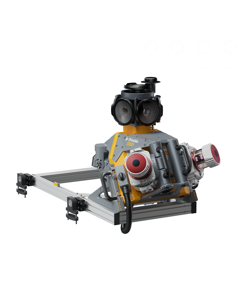
Trimble MX90
Achieve new levels of productivity.
The Trimble® MX90 system is part of a complete field-to-finish mobile mapping solution that combines leading-edge hardware with intuitive field software and an integrated office software workflow.
Benefits and performance
Premium, powerful mobile mapping solution
State-of-the-art GNSS and inertial technology, easy to install and simple to operate. With leading-edge image and lidar capabilities and intuitive field software.

Produce and share robust deliverables efficiently
Capture, process, extract and share high density point clouds and rich, immersive imagery to produce meaningful deliverables. Discover new productivity levels leveraging the complete Trimble field-to-finish workflow.

Laser effective measurement rate
Up to 3.6 MHz
Spherical camera
72 MP (6 x 12 MP)
Inertial Measurement Unit (IMU)
Enhanced GNSS precision
Features and capabilities

Quickly obtain geospatial data
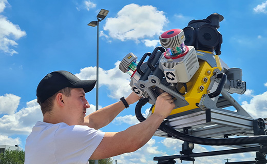
Control data acquisition with any smart device and easily adjust the lasers and oblique camera for the best orientation.

Combine GNSS & inertial data
Trajectory data processing using tightly coupled GNSS and inertial data incorporated into Trimble Business Center software.

High quality deliverables
Create, inspect and analyze high quality survey, engineering CAD and GIS deliverables, by leveraging the data fusion capabilities of Trimble Business Center.

Publish & collaborate
Avoid site revisits by sharing for-collaboration point clouds and images with overlaid existing asset data.

Industries and applications
The future of your work.
Trimble solutions facilitate high-quality, productive workflows and data exchange, driving value for a global, diverse user base.
Product Summary
Trimble MX90
For large-scale scanning and mapping missions.
Product
Specifications
Weight
Sensor unit 37 kg
IP rating
Sensor unit IP64
Spherical camera
72 MP (6 X 12 MP)
Planar cameras
2 X 12 MP side facing, 1 X 12 MP backward/downward facing
Laser effective measurement rate
Up to 3.6 MHz
Scan speed
500 scan/sec
Embedded Trimble GNSS-inertial system
Trimble field-to-finish workflow
| Weight (sensor unit) | IP rating (sensor unit) | Operating temperature | Storage | GNSS azimuth measurement system | Distance measuring indicator | Spherical camera | Planar camera | Laser scanner | Laser effective measurement rate | Laser field of view | Scan speed | Laser precision | Laser range accuracy | Maximum range, target reflectivity > 80% | Minimum range | Maximum number of targets per pulse | Embedded Trimble GNSS-inertial system | Field software | |
|---|---|---|---|---|---|---|---|---|---|---|---|---|---|---|---|---|---|---|---|
| Trimble MX90Trimble MX90 | 37 kg | IP64 | 0 °C to +40 °C | 2 x 4TB SSD removable | Yes, additional | Yes, additional | 72 MP (6 x12 MP) | 2 X 12 MP side facing cameras, 1 X 12 MP backward/downward facing camera | Dual Laser System | 600 kHz, 1 MHz, 2 MHz, 2.5 MHz, 3 MHz, 3.6 MHz | 360° | 500 scan/sec | 3 mm | 5 mm | 475 m (at effective measurement rate 300 kHz) | 1 m @ PRR ≥ 1 MHz, 1.2 m @ PRR < 1 MHz | Up to 15 (at 300 kHz and 500 kHz Laser Pulse Repetition Rate PRR) | X, Y: <0.01 Z: 0.01 | TMI, browser-based, no installation necessary |
| Trimble MX60 CoreTrimble MX60 Core | 20 kg | IP64 | -10 °C to +50 °C | 2 x 4TB SSD removable | Yes, additional | Yes, additional | 30 MP (6 x5 MP) | 1 X 12 MP backward/downward facing camera | Dual Laser System | 1000kHz, 2000kHz selectable | 360° | 200, 400 scans/sec selectable | 1.5 mm | 2 mm | 150m at 1000kHz 120m at 2000kHz | 0.6 m | 1 | X, Y: <0.01 Z: 0.01 | TMI, browser-based, no installation necessary |
| Trimble MX60 ProTrimble MX60 Pro | 22 kg | IP64 | -10 °C to +50 °C | 2 x 4TB SSD removable | Yes, additional | Yes, additional | 72 MP (6 x12 MP) | 1 X 12 MP backward/downward facing camera | Dual Laser System | 1000kHz, 2000kHz selectable | 360° | 200, 400 scans/sec selectable | 1.5 mm | 2 mm | 150m at 1000kHz 120m at 2000kHz | 0.6 m | 1 | X, Y: <0.01 Z: 0.01 | TMI, browser-based, no installation necessary |
| Trimble MX60 PremiumTrimble MX60 Premium | 24 kg | IP64 | -10 °C to +50 °C | 2 x 4TB SSD removable | Yes, additional | Yes, additional | 72 MP (6 x12 MP) | 1 X 12 MP backward/downward facing camera | Dual Laser System | 1000kHz, 2000kHz selectable | 360° | 200, 400 scans/sec selectable | 1.5 mm | 2 mm | 150m at 1000kHz 120m at 2000kHz | 0.6 m | 1 | X, Y: <0.01 Z: 0.01 | TMI, browser-based, no installation necessary |
Mobile mapping
Trimble MX90
Get in touch for recommendations for the Trimble Geospatial hardware, software, and accessories needed to get your job done.
Request a demoWorks with...


Trimble Business Center Mobile Mapping

Resources and knowledge


Watch what Trimble can do


Deepen your knowledge
Read customer success stories, ebooks, white papers and more.
Want to learn more?
Contact Trimble Geospatial today.