Office software
Trimble Business Center Mobile Mapping
Driving to actionable deliverables.
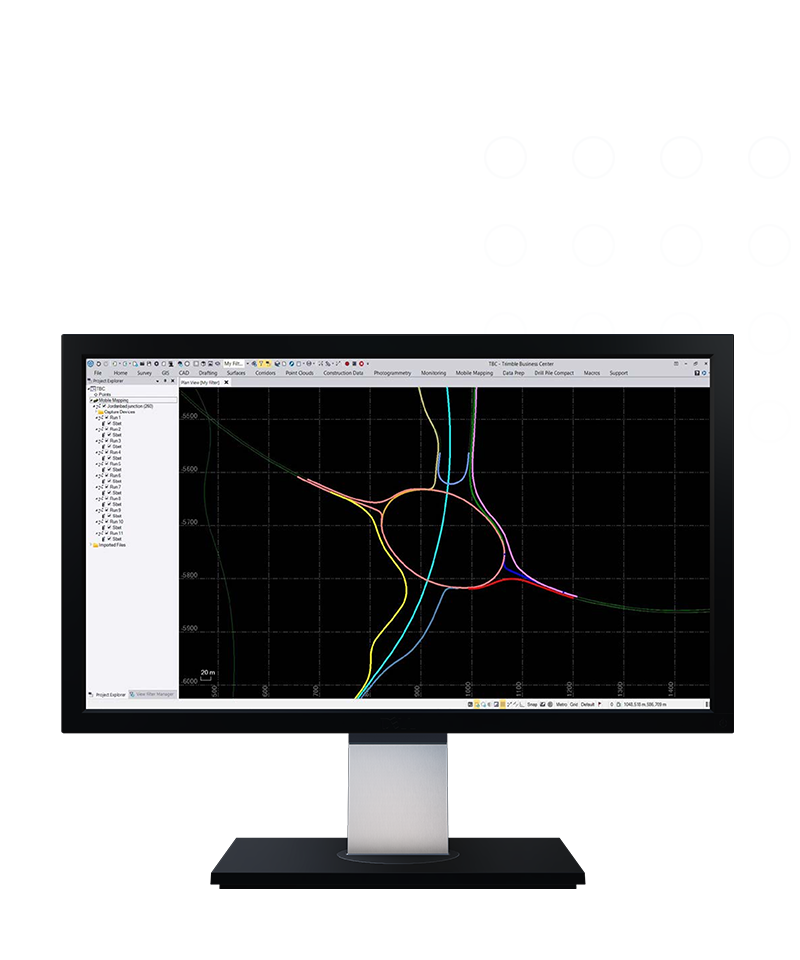
With Trimble® Business Center (TBC) mobile mapping office software, combine raw field positions, point cloud scans and multiple camera positions into the highest quality, most actionable information—in a single software.
Benefits
Robust & accurate deliverables
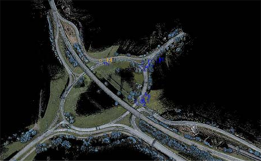
Use TBC's point cloud classification and feature extraction tools or utilize CAD, triangulated surface and contour lines, blur images and more—within one software.
Extend your mobile mapping investment
Connect your mobile mapping deliverables to GIS databases, Trimble MX software, or use TBC's numerous dedicated third-party exports to take your data further.

Affordable
Lower upfront costs
Flexible
Built around your needs
Always up-to-date
Benefit from enhancements
Features and capabilities

Process & deliver with TBC
With integrated Applanix POSPac trajectory adjustments and batch processing, move from raw data to deliverables quickly with efficient steps.

Flexible, powerful registration
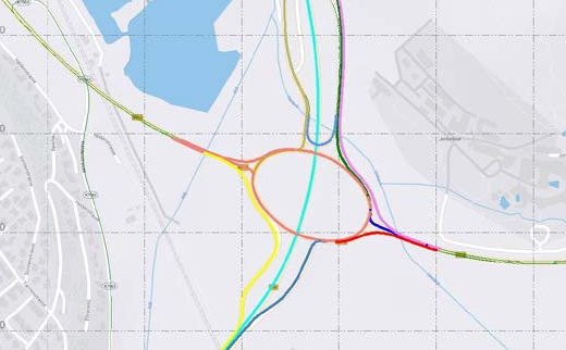
Leverage intuitive ground control picking tools and multiple-run registation options to ensure both precise and accurate point cloud and image information.

Robust client deliverables
Segment and classify your point clouds, automatically extract assets and attributes, create surfaces, corridor models and cross-sections and more.

Present your best data
Deliver your mobile mapping data with dedicated thrid-party exports and GIS database connections, or use TBC's growing number of point cloud and image tools.

Industries and applications
The future of your work.
Trimble solutions facilitate high-quality, productive workflows and data exchange, driving value for a global, diverse user base.
Product summary
Trimble Business Center Mobile Mapping
From raw mobile mapping data to actionable information.
Product
Features
Topography & existing conditions
Capture site features
Roadway cross-sections & profiles
View & manipulate slopes
Pavement inspection
Dense data for mitigation evaluation
Asset inventory & management
Populate feature databases
Utility line survey & inspection
Above-ground tracking & clearances
Office software
Trimble Business Center Mobile Mapping
Get in touch for recommendations for the Trimble Geospatial hardware, software, and accessories needed to get your job done.
Request a demoWorks with...


Resources and knowledge


Watch what Trimble can do


Deepen your knowledge
Read customer success stories, ebooks, white papers and more.
Want to learn more?
Contact Trimble Geospatial today.