Exploring Trimble Access v2024.10
Trimble® Access™ software version 2024.10 introduces a set of updates focused on enhancing measurement and data collection, expanding integration and interoperability, and streamlining the construction layout and stakeout processes.
Through practical improvements and user-centric features, the new release addresses the evolving needs of surveying professionals, ensuring field operations are precise and efficient.

Watch the Trimble Access 2024.10 Overview
Measurement and data collection enhancements
Trimble Access v2024.10 introduces practical improvements to measurement and data collection, with focused enhancements that simplify the user experience and improve data accuracy.
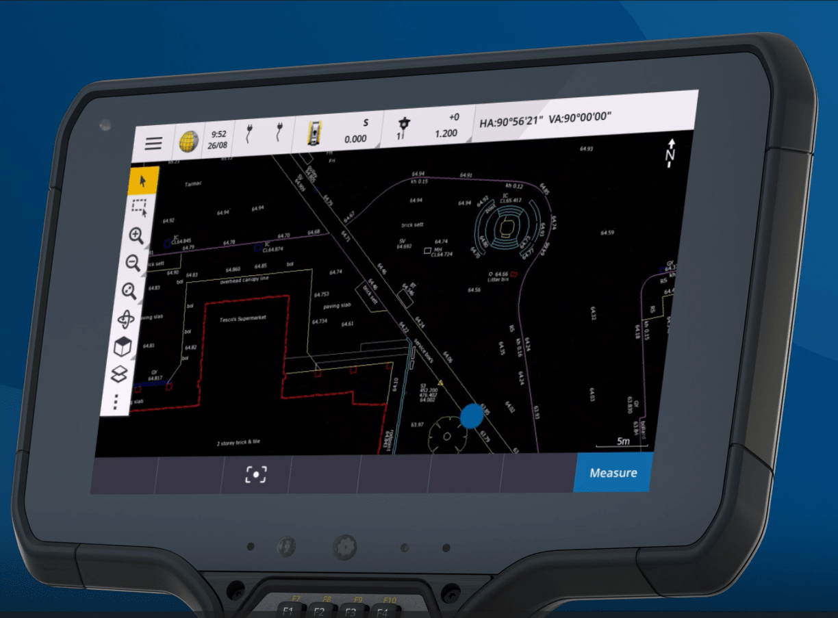
The introduction of a dark mode setting for maps is a game-changer for surveyors working under varied lighting conditions. This feature not only reduces eye strain during nighttime operations but also significantly enhances the visibility of intricate designs and detailed drawings against a dark background.
 Image: New dark mode setting for maps reduces eye strain
You can now add function keys for the Measure Topo/Points measurement methods, so you can swiftly transition between the different measurement methods. This feature can be used along with measure codes. For instance, if frequently measuring trees using the "measure HZ offset" method, you can assign this method to a function key. Then, when it's time to measure a tree, simply select the tree code in measure codes and press the function key to jump straight to the "measure points" form with the tree code and "HZ offset" method already set.
Enhancements to the taped distances routine makes it even easier to measure a building with a tape measure. With more options for starting and closing points, you can either start on two known points or start from one known point and tie into another known point. When closing on a known point, the misclose is displayed and can be adjusted, providing immediate confirmation that no mistakes have been made and any minor rounding errors are fixed.
Another improvement introduced in this release is the ability to review the length and area of polylines and polygons, providing easy access to critical information for set-out or infield planning.
Integration and interoperability
This update extends the integration and interoperability capabilities of Access, facilitating smoother workflows between different platforms and devices.
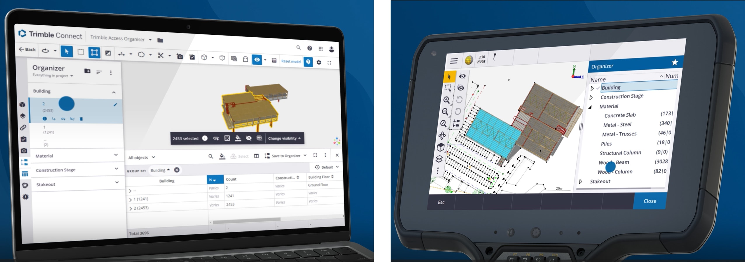
The support for rule-based groups from Trimble Connect® Organizer introduces a new layer of efficiency in managing project items, allowing surveyors to automatically organize elements based on specific criteria.

Image: Use the same organizer filters across Trimble Connect and Trimble Access
The introduction of total station data output over Bluetooth and GNSS NMEA support over Bluetooth for Android devices broadens the scope of connectivity, ensuring seamless data transfer from Access to a range of third-party devices, such as ground penetrating radar. Additionally, the inclusion of KML support and Bentley LandXML export compatibility further enhances Access' interoperability with various platforms, facilitating a more integrated workflow.
Surveying and staking enhancements
Trimble Access v2024.10 introduces a new intuitive approach to computing azimuths; when combined with the split-screen stakeout offset form, this becomes a standout feature, simplifying how stakeout offset directions are applied. For example, when setting out infrastructure along a road or property boundary, you can now easily offset a point in the same direction as the road or boundary by simply tapping the line in the map to copy its azimuth. To offset the point perpendicular to the road or boundary, tap at the end of the azimuth field and add 90 degrees to the azimuth. These two enhancements make it significantly easier to apply and use stakeout offsets, reducing the likelihood of errors during stakeout.
You can now easily add and stake extra points within the Trimble Access Roads app without switching applications, simplifying the integration of infrastructure details like drainage systems or road furniture into road construction projects.
Setting out blast holes for mining extraction in Trimble Access Mines is now easier than ever. With new sorting and reordering capabilities, stake out faster and manage data with more ease. For more advanced underground surveys, the Trimble Access Tunnels app has been enhanced to provide faster access to key functions, such as selecting specific zones during the auto scan routine and performing scan inspections for shotcrete and excavation control.
Additionally, set-out points such as rock bolts, blast patterns and pipe umbrellas are now visually displayed in the 3D map view, enabling greater control over the stakeout process for tunnel construction.
Update to Trimble Access v2024.10
For more information on this release, the following assets are available:
- Release notes
- Trimble Access YouTube channel (v2024.10 overview and tips)
- Help portal
Keep up-to-date on Access updates and tips from peers by joining the Trimble Access user community
Ready to upgrade to Trimble Access software v2024.10 today? Contact your local Trimble authorized distributor.