What's New in Trimble TerraFlex Version 5.10
Capture More, Work Faster—Above and Below Ground
Trimble® TerraFlex® software version 5.10 introduces new enhancements to automate field data capture and improve data reliability and quality, delivering increased efficiency in the field.
Download the latest version now from the Google Play Store and Apple App Store.
Field worker utilizing an RD8100 utility locator with TerraFlex to locate underground cables
Trimble TerraFlex is a single, streamlined software solution that unites easy, intuitive field data capture with high-accuracy GNSS positioning. With TerraFlex, deploy streamlined and integrated field workflows that require minimal training and that adapt to any application or scenario.
External Sensors Integration
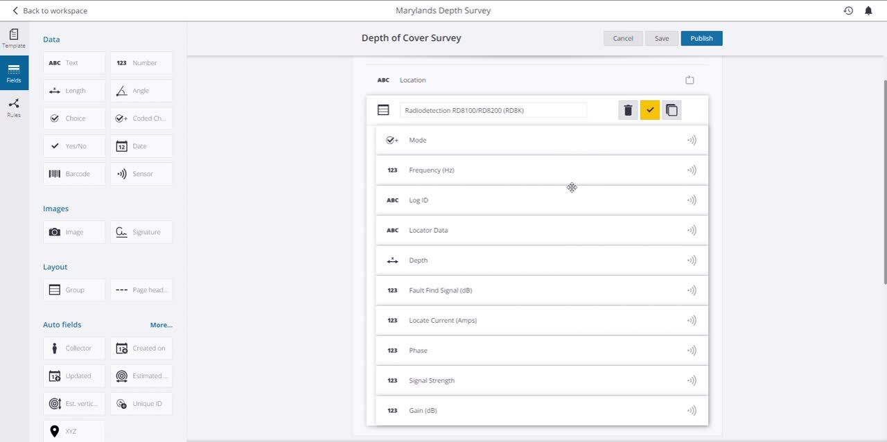
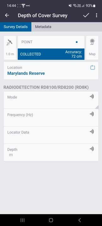
New in this release is the option to integrate external Bluetooth® sensors into TerraFlex data collection workflows. You can configure the measurements you capture in your form, and have the measurements from the sensor stored automatically when the sensor is triggered. Connecting your sensor with TerraFlex avoids time-consuming manual data entry, eliminates errors and improves field efficiency.
Three types of sensors are supported in this release:
- Radiodetection RD8100 and RD8200 utility locators
- Vivax Metrotech vLoc3 Pro utility locator
- LTI TruPulse® 200 and 360° series lasers rangefinders
The RD8100 and RD8200 and the Vivax vLoc3 Pro are industry-leading underground utility locators which, when paired with TerraFlex, provide a streamlined solution for accurately mapping the location of buried utility networks or for measuring and validating the depth of buried assets.
Field worker using an LTI TruPulse laser rangefinder with TerraFlex to measure the height of a utility pole
The LTI TruPulse laser rangefinders can already be used with TerraFlex to capture the location of assets. With this update, these laser rangefinders can also be used to measure the height of an asset—like a tree or power pole—to store that value directly to a form.
 Adding a sensor field to a form template in the TerraFlex form template editor

Measurements from an RD8100 being populated into a form in TerraFlex
Trimble TIP
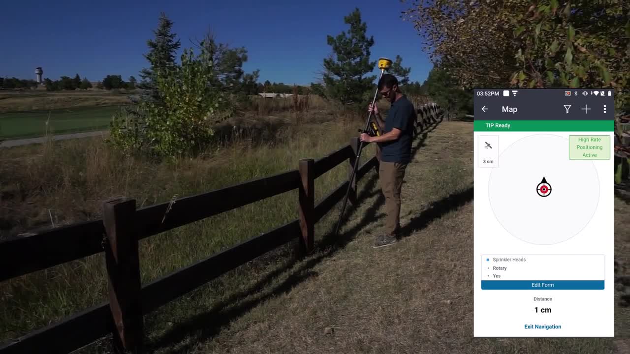
You need to be able to trust the integrity and accuracy of your field data to drive your business decisions. Trimble TerraFlex version 5.10 introduces support for Trimble TIP™ technology within Trimble R12i or R780 GNSS receivers that can now be utilized in TerraFlex data capture workflows. Trimble TIP enables quick and accurate stakeout of assets without needing to level the pole and the ability to capture assets in locations that are difficult or hazardous to access, such as on busy roads.
 Field worker using a Trimble R780 GNSS receiver with Trimble TIP technology to stakeout points using Trimble TerraFlex
Webinar
View an on-demand webinar to hear the TerraFlex product team discuss the benefits of the new features and enhancements in TerraFlex version 5.10.
Learn more about Trimble TerraFlex here.