Exeter underground: Surveying the city’s hidden history
Exeter, UK, holds a secret beneath its bustling streets: a 390-meter network of medieval tunnels, some as narrow as 430mm. These 14th-century passages, designed to house lead pipes for fresh drinking water, are the only ones of their kind open to the public in the UK. When asked to survey these historical tunnels and precisely tie them to the topography above, Exeter-based Benchmark Surveys knew it was the kind of complex challenge they excelled at. This remarkable heritage project was delivered successfully, thanks to a fully integrated Trimble workflow.
Documenting the past with precision
For James Richards, Director of Benchmark Surveys, this project was both professionally and personally rewarding. The initial brief from Exeter Council was to capture detailed 2D and 3D data of the tunnels for floor plans, sectional drawings, and a DWG-format topographic survey.
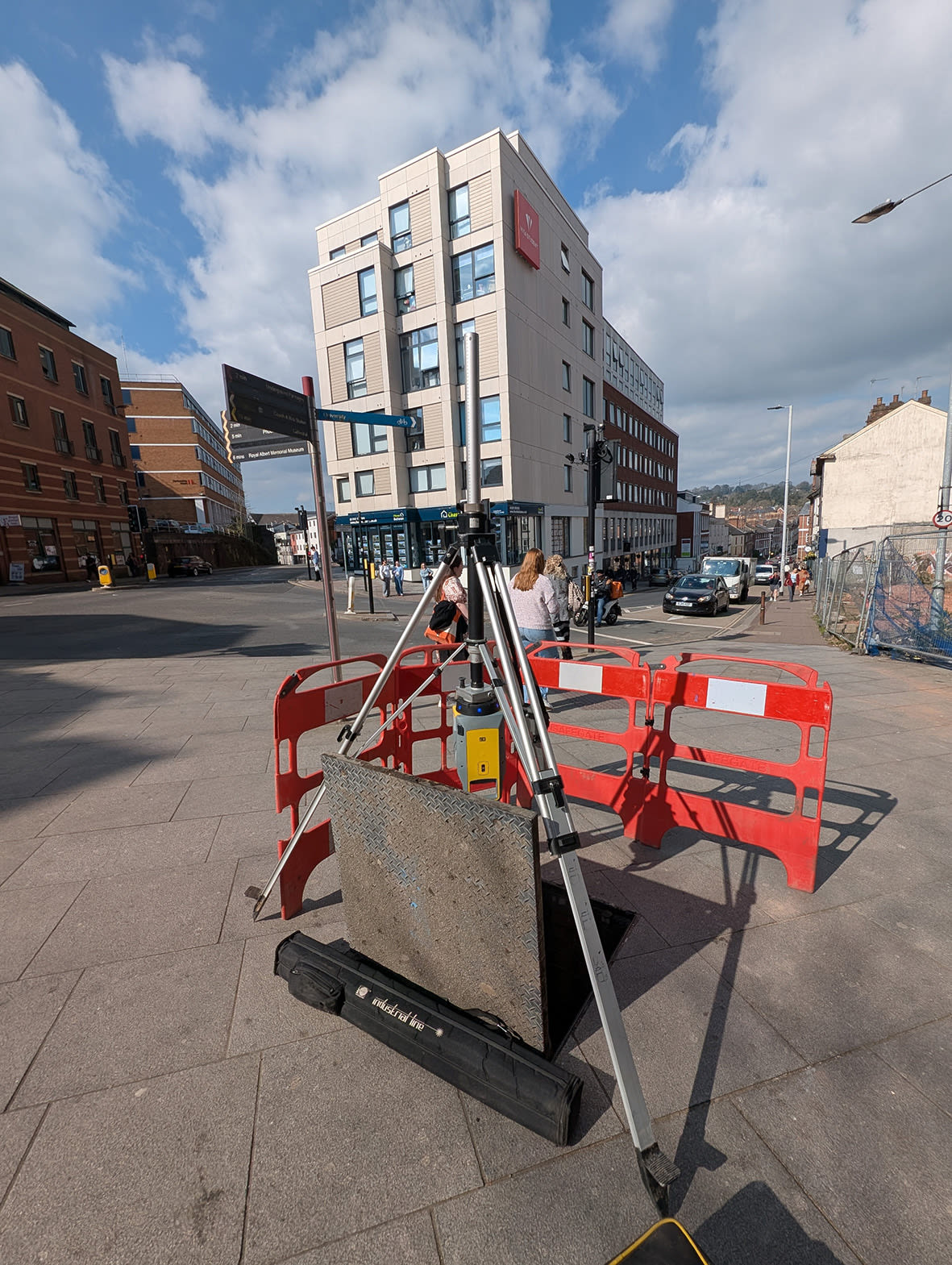
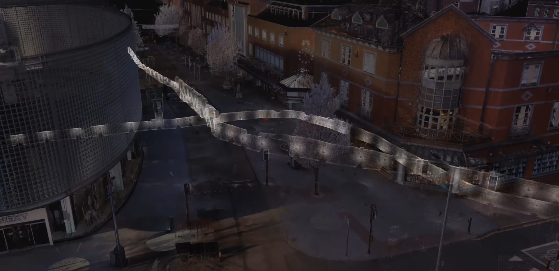
Above ground, the team used a Trimble® R12i GNSS receiver to establish position and the longest baseline. They then deployed a Trimble S9 total station to create a highly accurate control network, minimizing drift for the laser scanner work within the tunnels. Four connection points — two tunnel exits, a manhole, and a shopping center access — were scanned using a Trimble X7 3D laser scanner, with the X7 even used on an inverted tripod at the manhole site to link the above and below-ground surveys. All topographic work was completed in under three days.
Overcoming underground challenges
The unique environment of the tunnels presented significant challenges:
- Drift: Accurately positioning the tunnel in relation to the surface topography was paramount. The Trimble S9’s high-quality control above ground, combined with the Trimble X12 3D laser scanner's accuracy, ensured minimal drift and reliable alignment.
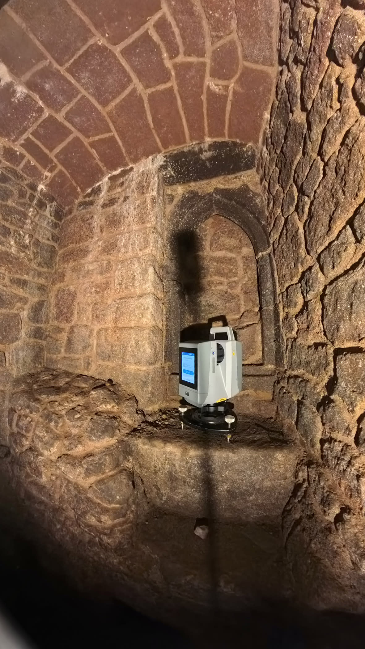
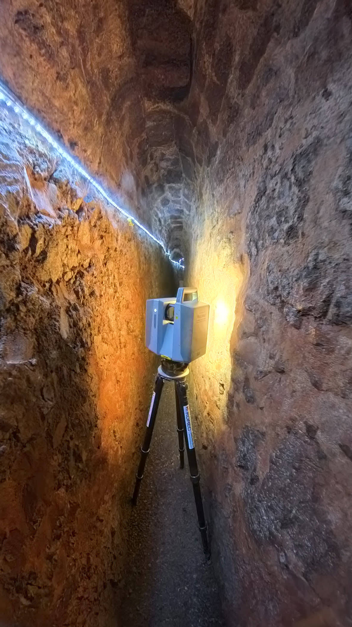
- Tunnel width: With widths varying from 930mm down to just 430mm, using a tripod was often impossible. The X12 proved invaluable with its compact form factor, low weight, and a minimum measurement range of just 300mm, allowing it to capture every detail even when placed directly on a trig plate.
- Low light: The X12’s built-in LED spotlights provided impressive, shadow-free illumination, capturing rich, accurate color data without needing additional lighting.
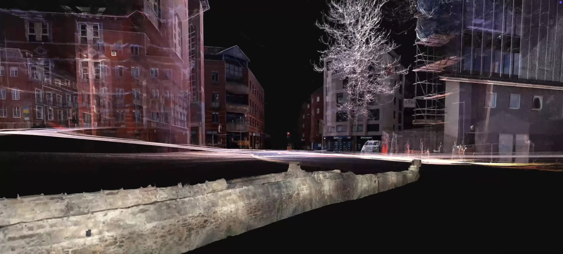
Over two days, 131 scans captured the entire tunnel network, including manholes and doorways, perfectly aligning with the 243 scans of the modern structures above.
Seamless integration and lasting value
Back at the office, Trimble RealWorks software processed the extensive linear scan data. Instead of a traditional cloud-to-cloud approach, which could accumulate errors due to the close proximity of scans, the data was segmented into manageable sections for processing and refinement. Trimble Business Center office software handled survey data, ensuring a seamless workflow.
"To be part of such a historic project in our hometown has been extremely rewarding," James Richards concludes. "We’re proud to have created something that far exceeds what was already in existence and hopefully create our own bit of history with this amazing dataset. The Trimble integrated workflow has been invaluable in the success of this project."
This project not only preserved a vital piece of Exeter's past but also showcased the power of integrated Trimble technology in tackling the most demanding surveying challenges.