Measuring the world
The rain has softened the forest floor. Captain Stefan Wacke skillfully maneuvers the Eagle IV through a mud hole. Water splashes up and the tires sink into the deep puddle. The Schavener Heide training area offers perfect conditions for today's off-road training. Wacke is assigned as the driver of the protected military vehicle. Next to him, senior sergeant Moritz Langheinrich is studying data on a tablet. The two soldiers are working for the Bundeswehr's geoinformation service in nearby Euskirchen. On the platform at the rear of their Eagle IV is their weapon system: the Trimble MX9, a state-of-the-art mobile mapping system.

For terrain exploration, the Trimble MX9 is mounted on a special roof rack on the Eagle IV. For protection and space reasons, all necessary system components are housed outside the vehicle.
Measuring terrain with pinpoint precision
The geoinformation service takes on important support tasks in the Bundeswehr. Its 1,700 military and civilian experts produce, among other things, country maps, weather forecasts and analyses of the terrain. The combat force can use the data to position itself, navigate and act against the enemy. Wacke and Langheinrich belong to the Kinematic Data Acquisition department, their specialty is to survey and map an environment with a mobile data capture system.
"The system misses nothing within a radius of 250 meters."
— Captain Stefan Wacke

Left: The system is equipped with two hard drives that record the data from the cameras and lasers. The data can only be decrypted by the manufacturer's software. Right: The cameras point in different directions to capture images from all angles. The lasers provide three-dimensional measurements to calculate length or distances.
Experts also call it mobile mapping. Normally, Wacke sits in the passenger seat as survey chief and commander. Langheinrich's usual workplace is a high-performance computer for evaluating the data. Today, the senior sergeant is supposed to provide support in the field. “We often swap roles during exercises because everyone has to be able to do everything in the end,” explains Wacke.
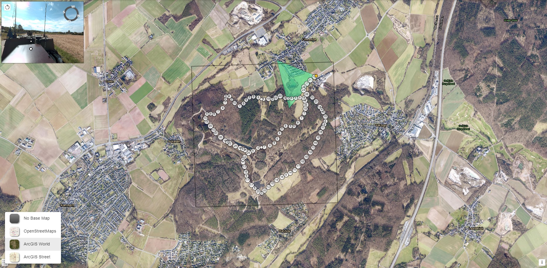
The Eagle IV fights its way through the mud. Then they go over a stone course. “The path used to be a driving practice track for the Bundeswehr. We use it regularly for off-road driving,” says Wacke. The captain is clearly having fun tilting the eight-ton vehicle. Next to the track is a large meadow that is used as a shooting range. The soldiers are also supposed to survey the lawn which is part of the shooting range. The Trimble MX9 records every obstacle, every tree and every elevation. “The system doesn’t miss anything within a radius of almost 250 meters,” explains Wacke. The device is considered the best on the market. It can not only be used in the field, but also to record towns, streets or field camps.

The Bundeswehr owns around 670 Eagle IV and V vehicles. These protected command and functional vehicles are versatile and provide occupants with protection against IEDs, mines, and direct fire.
During the mapping project, the mobile mapping system recorded for one hour and 20 minutes, generating approximately 16 gigabytes of data. The navigation data allows the route and the images to be precisely determined.
Wacke and his comrades have already been to Afghanistan and Mali to analyze the infrastructure for the action forces. Since national and alliance defense became the focus again, their profiles have changed. “At the moment we are increasingly surveying road networks so that units can plan the relocation of their troops,” explains the captain.
"We provide the end user with a complete data set."
— Senior sergeant Moritz Langheinrich
Supporting the combat troops
“Many people know the concept of Google Street View,” says senior sergeant Langheinrich. The US company has cars with cameras on the roof drive through cities in order to digitally record streets, intersections and houses for its search engine. “The Trimble MX9 does not only have cameras, but also laser sensors,” says Langheinrich. Nine cameras provide a 360-degree view of the vehicle. The two lasers are used to spatially measure the environment.
“We combine the images and laser data on the computer to create a 3D model. “You can then, for example, measure distances or the conditions in an area,” explains the data analyst. For example, a marching column can be planned specifically in advance. You can read the clearance heights of bridges or the degree of inclination of exit roads in the 3D model so that tanks and special equipment can get through unhindered. During combat, previously collected geodata supports the decisions of the military command – from the positioning of the command posts to the measurement of the positions.
The Eagle IV is now on the meadow. Langheinrich monitors on the tablet whether the Trimble MX9 is running smoothly and whether the route is being followed. Blurred measurements are shown as white areas in the 3D model. “This happens, for example, behind thick trees and hedges,” says the senior sergeant. “If we cannot map an area correctly, we adjust the route.”

During the analysis, the perspectives of the cameras can be adopted. The points are the position data of the vehicle, which can be selected.
The Bundeswehr currently has one mobile mapping system and the second one is due to arrive at the end of the year. The system is flexible and can be mounted on various vehicles. The team uses the VW Widder T6 in traffic. It's faster and the controls can be stored in the vehicle. The Eagle IV is for off-road use. Batteries, processors and storage media are stored in a special attachment on the rear. “We have two hard drives with two terabytes of storage each. One is for the cameras, the other for the lasers,” explains Langheinrich. The system can record up to eight hours at a time.
"With our data, troops can be quickly deployed."
— Lieutenant Colonel Dennis Stephan
Preparing for troop transfers
“We see ourselves as service providers for the troops,” says Lieutenant Colonel Dennis Stephan, head of the Kinematic Data Acquisition Department. Every Bundeswehr unit can take advantage of the support service. “An informal request is enough. We then check how we can implement the customer’s order.” There is a major order from the military police on Stephan's desk: “We are supposed to measure the entire motorway network in Germany.”
Around 13,000 kilometers if you add up both directions, all exits and rest stops. A mammoth task for the 13- person team, but important for Germany's role as NATO's logistical hub. The team measured the main roads in the Baltics two years ago.

The recordings from the laser sensors are represented on the computer as point clouds. The clouds consist of countless coordinates that, after matching with satellite data, show spatial information.
Like the entire Bundeswehr, the geoinformation service is preparing for national and alliance defense. “With our data we provide the basis for quickly moving troops and material from west to east in the event of a defense,” explains Stephan. This not only affects the German forces, but also the Allied forces that arrive in Germany for onward transport. When it comes to providing the necessary geoinformation, the Bundeswehr is well positioned compared to other countries.
Only a few other countries cover all 18 sub-disciplines of geosciences. At the end, Stephan's department provides the recipient with a link with the entire data set. “A web-based 3D model in which you can display a route or an area in all its details,” says Stephan. The Army has already announced that it needs support in relocating the future Lithuania Brigade. The team has no shortage of work.
Evaluation in the barracks
Captain Wacke is back in the barracks with the Eagle IV. The images are good, the rain didn't harm the lenses and sensors. The dirty military vehicle is in a workshop where the computers for data analysis are also located. “Now the main work begins. You can say that recording accounts for around 20 percent of our work, 80 percent is needed for evaluation,” says Wacke.
He's done his part for today; he'll wash the vehicle tomorrow.

Senior sergeant Moritz Langheinrich uses the manufacturer's software SOLV3D for data analysis. Data privacy-related items such as faces or license plates are pixelated.
Senior sergeant Langheinrich backed up the hard drives and imported the data into his computer. Despite the powerful computers, importing the data can take a few hours. Depending on how long the system was in use. “It wasn't much today. We recorded an hour and 20 minutes. “That’s about 16 gigabytes of data,” says the senior sergeant.
First, the navigation satellite data is evaluated. “We use multiple satellite systems to precisely locate our recordings. The location data forms the basis for our measurements,” explains Langheinrich. The images and laser data are then calculated. The images from the laser sensors are displayed as point clouds. The clouds consist of millions of individual points, each of which has a specific coordinate. This digitizes the spatial features. The senior sergeant shows the 3D model on his screen. In one picture he measures the length of a wrecked tank on the firing range. A point cloud illustrates the vegetation density of the driving school route.
“When an official order is placed, we give the recipient a ready-made data set and advise them on how the results can be used,” says Langheinrich.
The military and scientific craft of the geoinformation service is currently particularly needed in the Bundeswehr. The Kinematic Data Acquisition Department is preparing for strenuous months ahead. “The order of the military police will be a permanent task,” says department head, Lieutenant Colonel Stephan. “But we are used to constantly tackling new tasks.” He and his team are prepared for this.
This story origially appeared in German in Das Magazin der Bundeswehr as "Die Vermessung der Welt."