Unlocking the power of 3D laser scanning: One surveyor’s secret to cutting costs, boosting data capture and winning jobs
Layton Surveys has just completed its largest and most complex job yet — scanning a property in downtown Salt Lake City spanning two city blocks — and in the process, Willis Long, CEO, has become an enthusiastic champion of 3D laser scanning.
Willis Long’s passion and dedication to excellence in surveying runs deep; he's even got a map of the United States, complete with a surveyor's compass and sextant, on his right arm. “Using the tech is a lot of fun, it's like walking around in a video game,” says Long, CEO and licensed land surveyor with Utah-based Layton Surveys, which operates in seven states. The firm has just completed its largest and most complex job yet — scanning a property in downtown Salt Lake City spanning two city blocks — and in the process, Long has become an enthusiastic champion of 3D laser scanning.
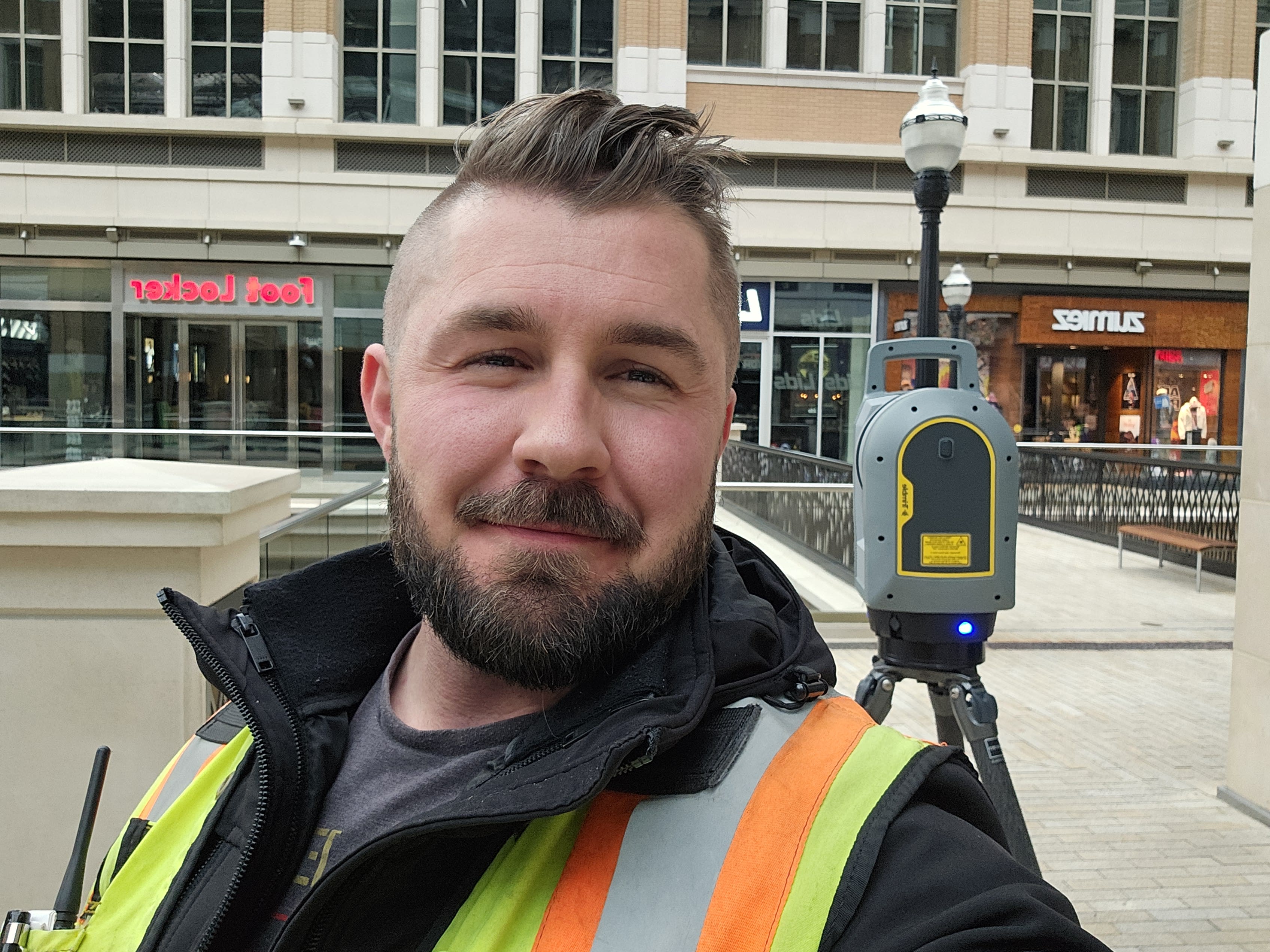
For this project, the customer was looking for an American Land Title Association (ALTA) survey, a formal survey of a parcel’s boundaries used in real estate due diligence. To that end, all improvements needed to be noted and detailed on the survey along with building heights and finished floor elevations.
The data gathered was used to create a 3D model and subsequent ALTA report. Long used the Trimble SX10 scanning total station to produce a georeferenced scan, and noted the ease with which the fast, data-dense Trimble X9 3D laser scanner scans could be tied to the SX10 data sets.
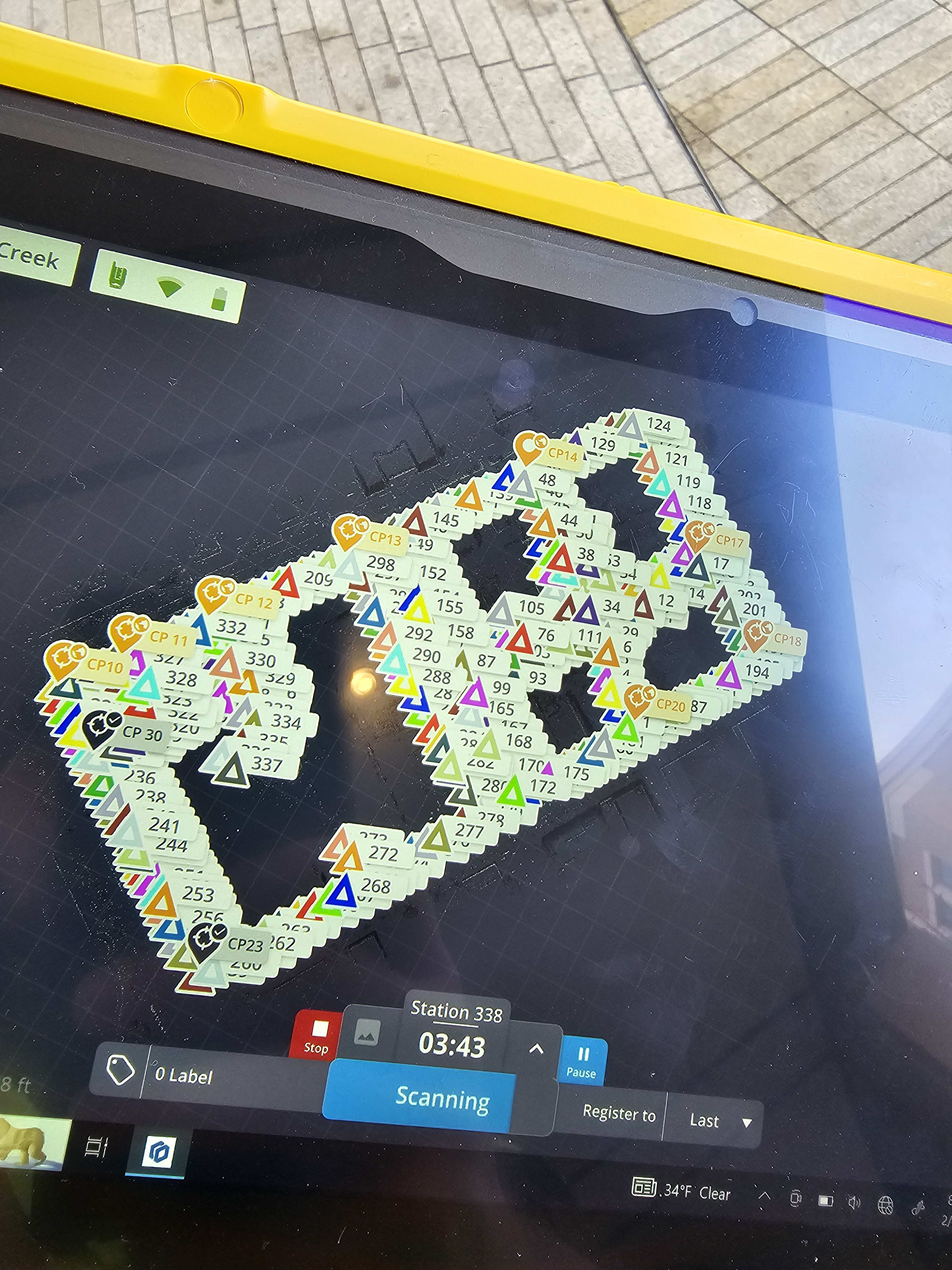
“Four SX10 robots paired with the X9 were indeed able to capture the entire city block!” Long shared on social media. “The updated version of Trimble Perspective stitches the X9 scans together amazingly even in suspect conditions. Between the SX10 data and the X9 data we ended the day with just shy of 200 scans. For reference, I did this same survey almost 12 years ago with a rag tape and a two-man robot team. It took me about three months to get the same amount of data that I did with five teams in one day.”
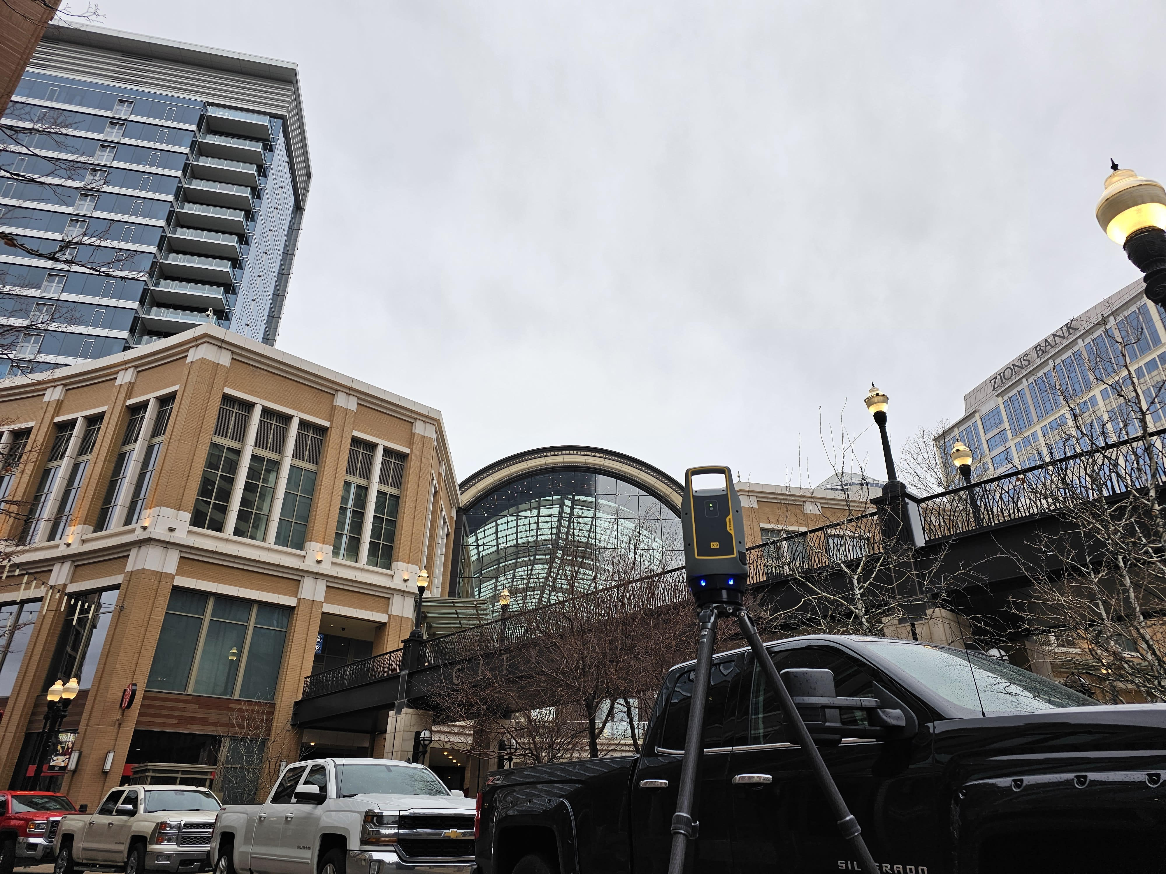
Adding a laser scanner to this workflow made all the difference, Long said. Here are some proof points:
- Between the SX10 and Trimble X7 and X9 scan data, Long’s team captured just over 600 scans to create a complete 3D model of two entire city blocks. This process, coupled with the aerial imagery gathered, resulted in a complete data set that could generate real-time measurements in great clarity.
- Using the SX10 to set 70 control points, the teams were able to consistently achieve .01x.01 accuracy for horizontal and vertical residuals, creating a framework for the scanning data sets. After each fresh set up, a scan was completed prior to the commencement of conventional mapping. To supplement the scan data, which is already georeferenced via the SX10 data set, the X7 meshed seamlessly into the SX10 data set, eliminating the need to set targets or spheres for controlling the purely terrestrial data sets.
- For this particular application Long’s team didn’t use any GPS. “From the first survey completed 11 years ago, we already had a control network, or at least the remnants of one. From there we set about 70 control points using the Trimble SX10 and then proceeded to scan using the SX10 and the X9 to gather all of our data on the ground. The data was also supplemented using aerial imagery gathered using the Autel Evo 2 Pro V3.”
- "The use of drones with aerial imagery and adding laser scanning cut the time needed for the job in half, " says Long, noting that a job covering 20 acres with 16 buildings and 200 residents used to take seven to 10 days and more than $15,000 worth of field work just to gather that info. “We’ve cut that time in half or a third to gather the same amount of information.”
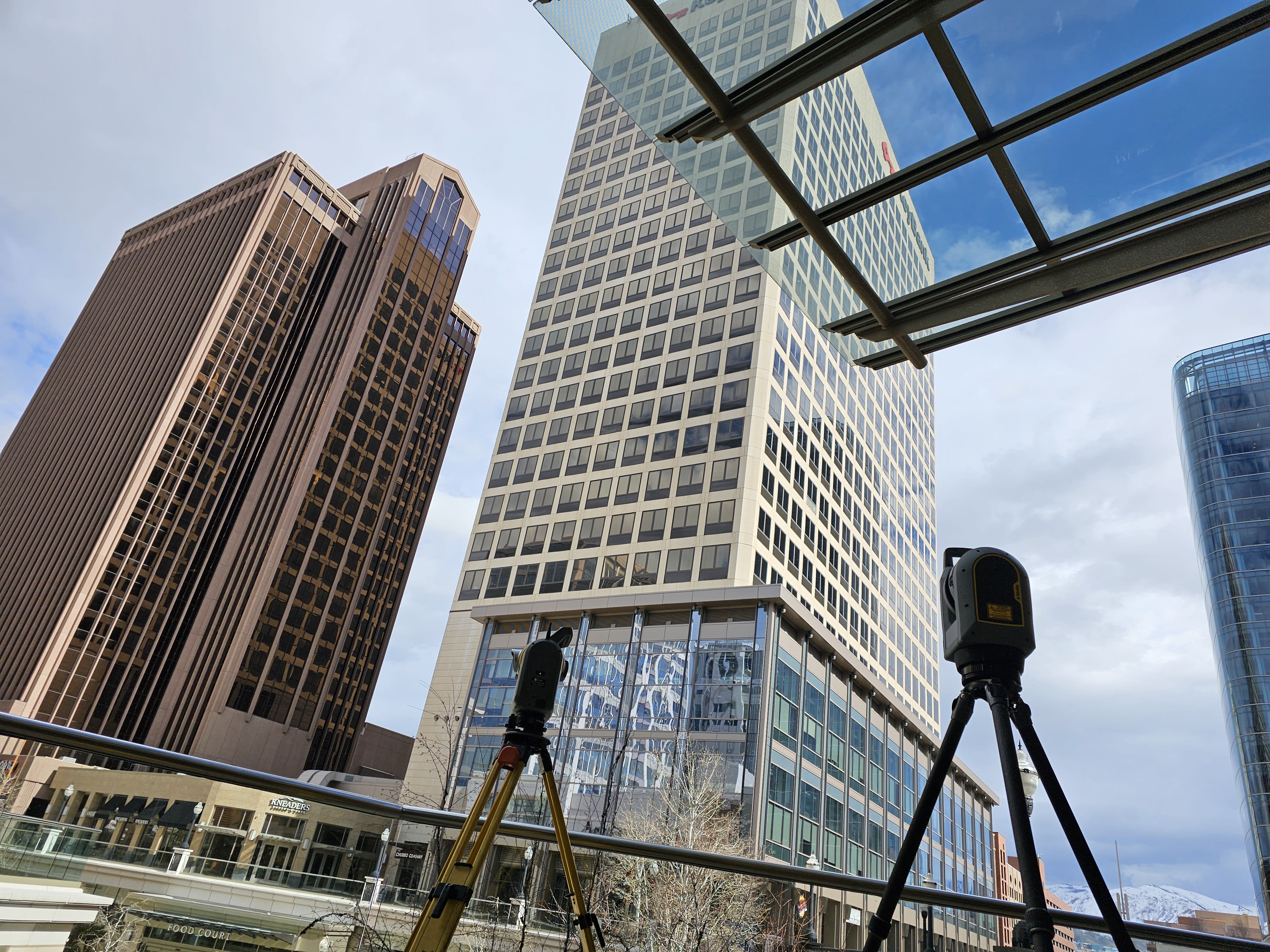
Another upside? Long says his firm is able to submit highly competitive bids for jobs not just locally, but further away as well. “A customer in Phoenix will pay us to drive 20 hours plus the cost of field services, and we will still beat out someone down the street from them,” he explains. “It’s because of the speed and increase at which we can gather the data, and the amount of data that can be gathered compared to traditional GPS and a standard robot is ten-fold."
Laser scanning is becoming popular tool in surveyors’ toolbox
Embracing 3D laser scanning in the survey industry is not just about the impressive leap in accuracy it provides — it's also about fundamentally transforming operational efficiency. This innovative technology significantly streamlines the survey process, marking a departure from the traditional, more laborious methods that have dominated the field. With 3D laser scanning, vast expanses and intricate details can be captured in mere moments, a feat that once demanded considerable time and manpower.
This shift toward efficiency is revolutionizing how survey projects are executed. Surveyors can now rapidly collect comprehensive data sets, reducing the need for multiple site visits – thereby slashing the time required to complete a project. This swift data acquisition not only accelerates project timelines but also contributes to a notable reduction in operational costs. The ability to swiftly gather data means surveyors can tackle more projects within the same timeframe, enhancing productivity and profitability.
Data management just got a whole lot easier
According to Long, the most significant difference achieved by adding a laser scanner to the workflow is the quality and quantity of the data. Long’s firm completed an ALTA survey of the same property in 2013, and had some interesting reflections. "I remember as a young man spending months gathering all the data and just as long processing it all into something for the client. This time around with 4 teams, 4 SX10s and the Trimble X9/X7 we were able to do the entire project in roughly 2 weeks in the field and about 2.5 weeks in the office resulting in significant cost savings for the client and for our company."
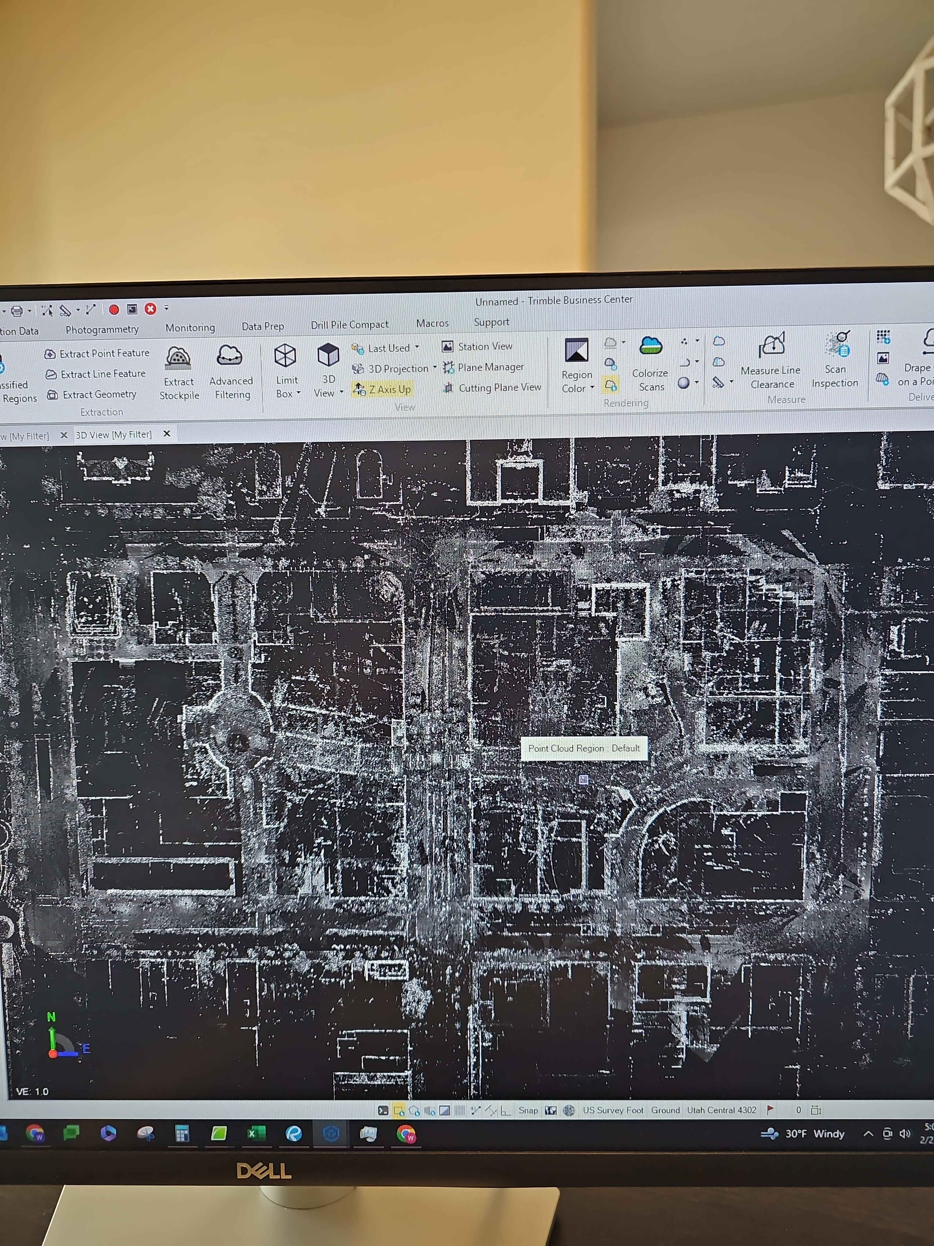
Before embarking on the City Creek project, Long built his company’s first ‘super computer’ that could handle 600 scanned files for just one dataset. “If you don’t have enough horsepower it can definitely slow you down,” he notes.
The nuanced data collected through 3D laser scanning enables a more streamlined approach to project management and execution. With high-resolution information at their fingertips, surveyors can quickly identify potential issues, make informed decisions and adjust their plans on the fly, all without the painstaking effort traditionally associated with these tasks.
This seamless integration of 3D laser scanning into survey practices not only propels the industry forward but also sets a new benchmark for what can be accomplished with the right technological tools. By adopting 3D laser scanning, survey firms position themselves at the forefront of a new era of efficiency and effectiveness in survey work.
Scanning injects new efficiencies into key survey workflows
For Long, who began surveying using Trimble equipment with his father at age 14 using manual total stations, scanners, drones and robotic total stations are now a regular part of surveying workflows. His firm currently uses Trimble® Access™ field software, Trimble Perspective and Trimble Business Center softwares, as well as the SX10, R10 and 12, TSC 7 and T10X. Long says the competitors’ solutions “just aren't as user friendly and lack a cohesive bond with third- party software such as Esri or MicroStation. Having to use multiple different software and systems in the field and the office makes data management and providing a high quality deliverable in a timely manner nearly impossible.”
Today, Long’s team is leveraging a full workflow from field to near finish using only Trimble software and products that involves setting control with the SX10 and the R10 receiver heads and meshing in X7 and X9 scan data made for an incredibly detailed 3D model of the entire project. “This reduced the amount of time spent mapping by nearly six times and made it so that any data we needed to add to the survey could be added without any additional trips to the field.”
He adds: “Trimble is always coming out with new products and workflows. If we can think of a project, it’s a safe bet that Trimble has some sort of product or application to help get the project completed.”
As the technology for surveying continues to evolve, Long’s passion for the business only seems to grow. “A lot of people don't get to be sitting in front of a computer crunching data, and then out working on the side of a mountain, all in the same week!”
Learn more about the Trimble scanning solutions.