Discover the latest features in Trimble 4D Control (T4D) version 6.6
Enhanced user experience during movement analysis
Trimble® 4D Control™ (T4D) office software has established its market position as a powerful, flexible and user-friendly software solution for monitoring — empowering customers to make better-informed decisions. Version 6.6 is out now, introducing key updates designed to enhance movement understanding through a new 3D viewer, and enhancing data quality by allowing users to remove noise and outliers in the new data maintenance section.
This new version supports the new Trimble GNSS Meter, providing customers with a cost-effective, battery-powered and autonomous GNSS solution. Combined with T4D, the GNSS Meter helps identify potential structural and safety risks in applications including mining slope movement, dams and bridges, landslides and landfills.
To learn more, visit the T4D webpage, read the release notes and download it here.
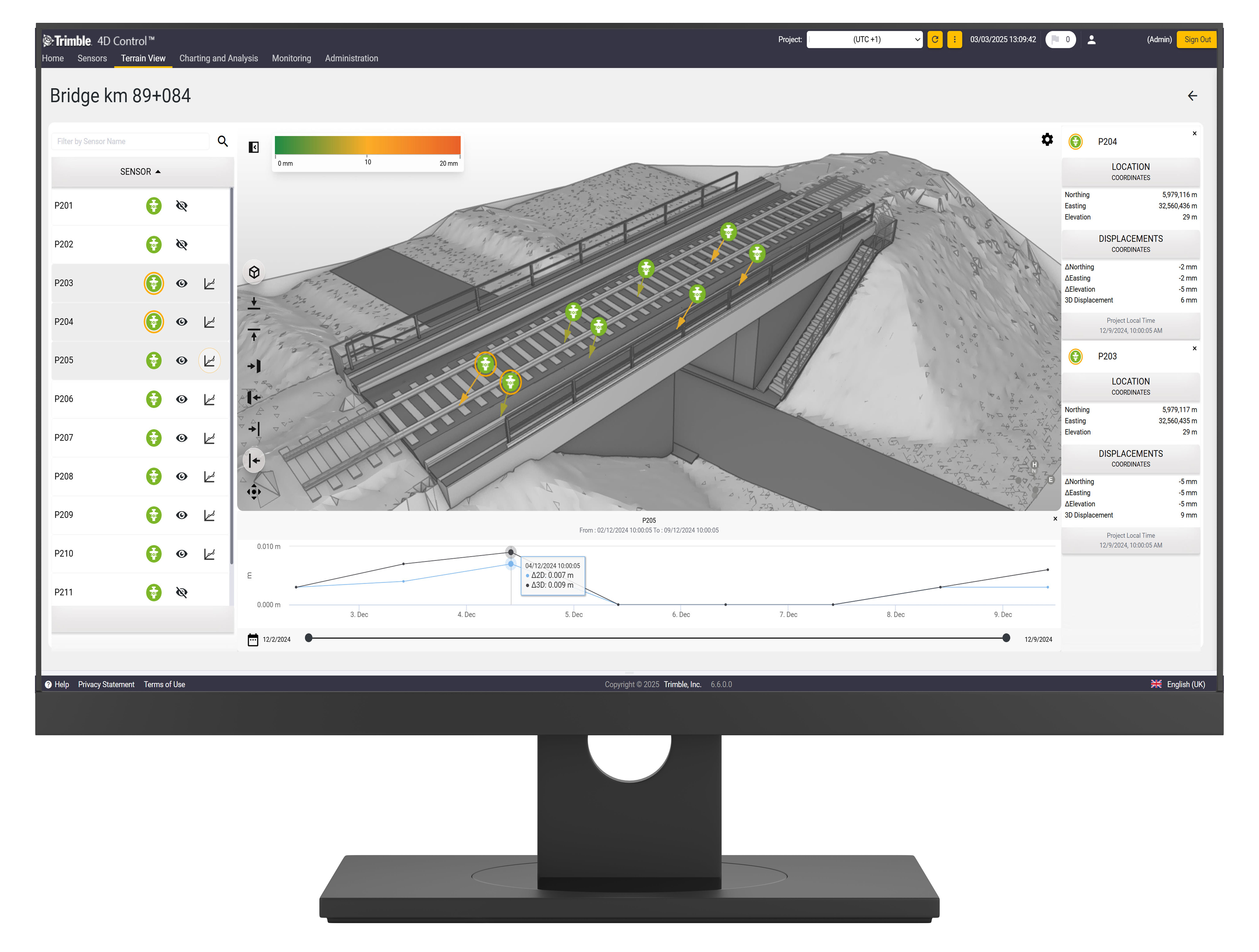
3D Viewer designed to make more informed decisions on movement
T4D offers various ways to present movement data to stakeholders, including tabular views, different types of charts, maps and more. In this release, the 3D viewer functionality and enhanced map view features provides greater insight into monitoring sensor data.
The new 3D viewer provides a more intuitive and comprehensive view of movement. Whether infrastructure, mine slope, landslide or any other area for which a model is available, it's now easier to understand changes over time. Sensors and displacement vectors can be visualized alongside models, providing greater insight into the movement of a structure or area. Additionally, charts provide another visual representation of movement or environmental change.
This improves decision making by identifying potential issues and facilitating informed decisions about movement for all stakeholders. Communication and collaboration among project teams is simplified as every interested party can be granted access to T4D to analyze movement.

Bridge monitoring project in 3D Viewer
Data maintenance feature enhances data quality
Noisy data can arise from various sources in monitoring projects, including poor quality backsight points due to disturbances or positional changes, missing backsight points in a measurement round, or user or instrument errors. These issues often result in spikes, outliers or unwanted data appearing in charts, analyses and trends, which can be problematic when sharing information with stakeholders.
For instance, if a construction machine obstructs the line of sight to the backsight point, it could cause a jump or spike in the results compared to when all backsight points are measured. This often raises questions, prompting comments in T4D to explain the issue or triggering discussions among the involved parties to understand the reason behind noisy data.
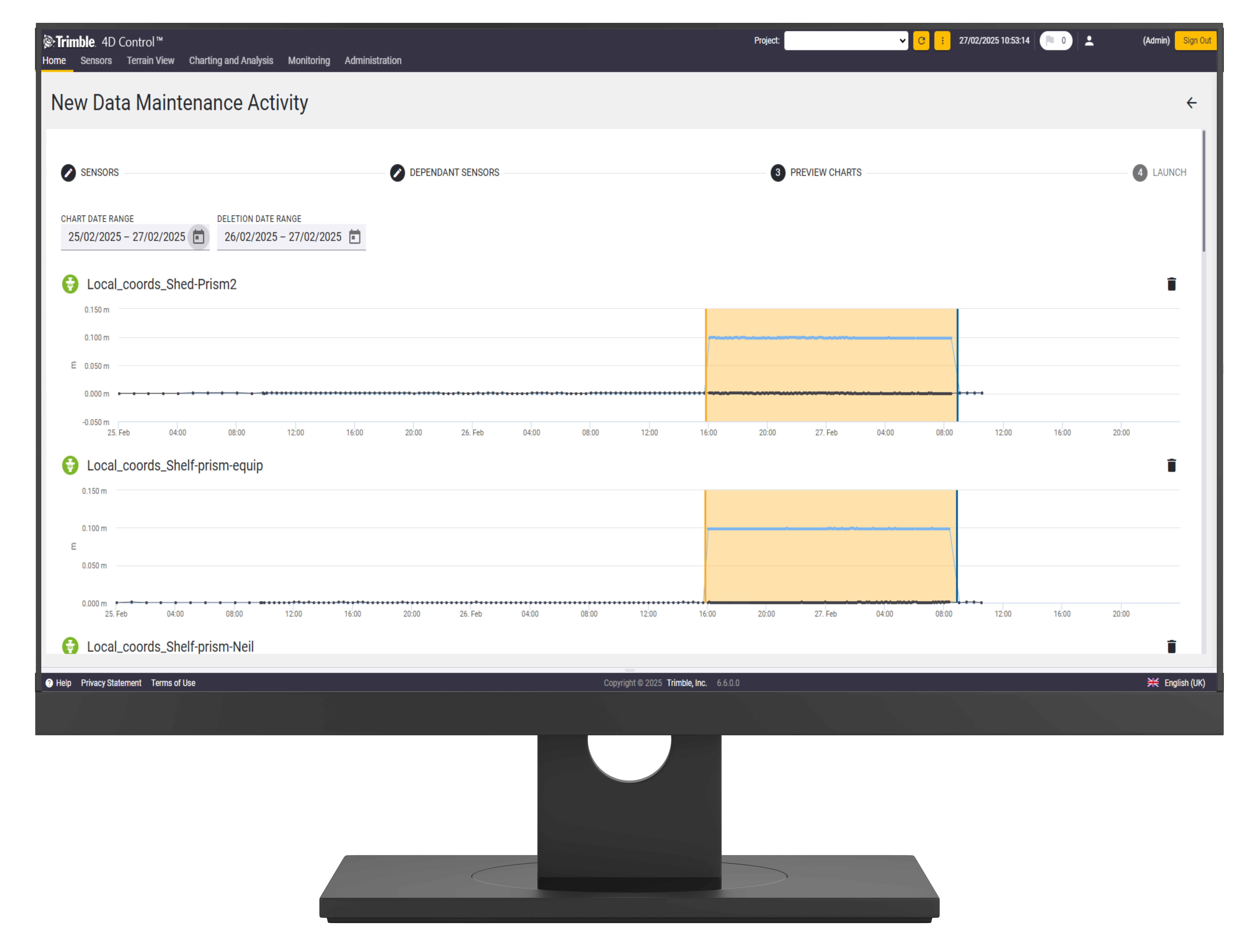
To address this, T4D now offers a data maintenance workflow that allows users to remove erroneous data more efficiently. Select the sensors, and T4D will identify and suggest other affected sensors, as well as offer graphical assistance in the next step to pinpoint erroneous data directly from the chart. During data maintenance, all trend and observation reductions are recalculated, enhancing data quality and ensuring confidence when sharing data. T4D logs all changes, so you can easily track for compliance reasons.

Data maintenance: Selecting the erroneous data to be deleted
Seamless integration with the cost-effective GNSS Meter
T4D v6.6 supports the GNSS Meter, providing a cost-effective solution for long-term 3D ground and structural movement monitoring. Designed specifically for the mining, construction and infrastructure industries, this solution minimizes the risks associated with land and structural instability.
Featuring a user-friendly setup and intuitive interface, it allows for rapid deployment of numerous sensors with minimal training, making it highly scalable. It leverages wireless IoT technology and an internal battery to reduce infrastructure costs by eliminating the need for extensive cabling and lowering maintenance expenses.
Corrections are transmitted from base to rover via LoRa (Long-Range) communication, eliminating the need for cellular coverage or internet access. This capability makes deployment in remote areas feasible and reduces the number of components and accessories needed compared to traditional systems.
Other key features include:
-
Survey-grade precision with advanced Real-Time Kinematic (RTK) technology
-
Flexible configuration options to function as either a base station or a rover for various monitoring needs
-
Innovative edge processing provides information on the quality of position measurements and system performance, transmitted via radio
-
Battery power source with a lifespan exceeding two years; backup solar power can be plugged in for even more longevity
-
Integrated tiltmeter delivers supplementary movement data even when conditions for precise RTK measurement are not met
Combined with T4D, users can benefit from seamless data integration for enhanced analysis, reporting and alarming, providing crucial insights to understand movement. This integration offers a comprehensive solution for effectively monitoring and managing structural and ground stability.
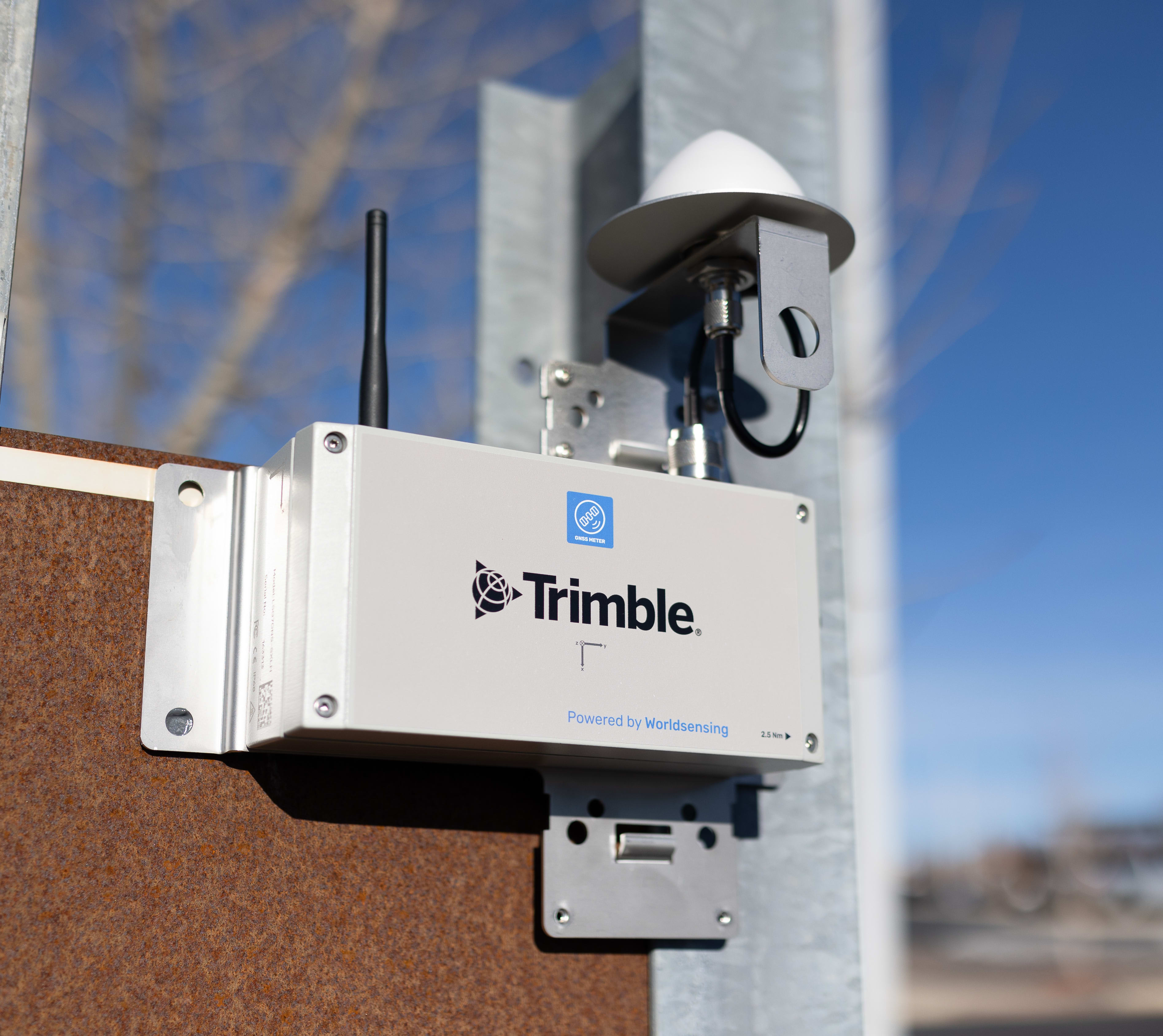
 Trimble GNSS Meter
To learn more about the new Trimble GNSS Meter, visit the product webpage or read the announcement.
Availability
For more information on monitoring and T4D, visit our product page or contact your local Trimble Distributor.