Geotechnical monitoring a heritage-listed bridge underpass in Brisbane
RPS, leading global professional services firm with more than 200 surveyors in Australia, was recently hired by the Brisbane City Council in Queensland, Australia. They were tasked with monitoring the stability of the heritage-listed Story Bridge using an automatic geotechnical monitoring system from Trimble® during a recent construction project.
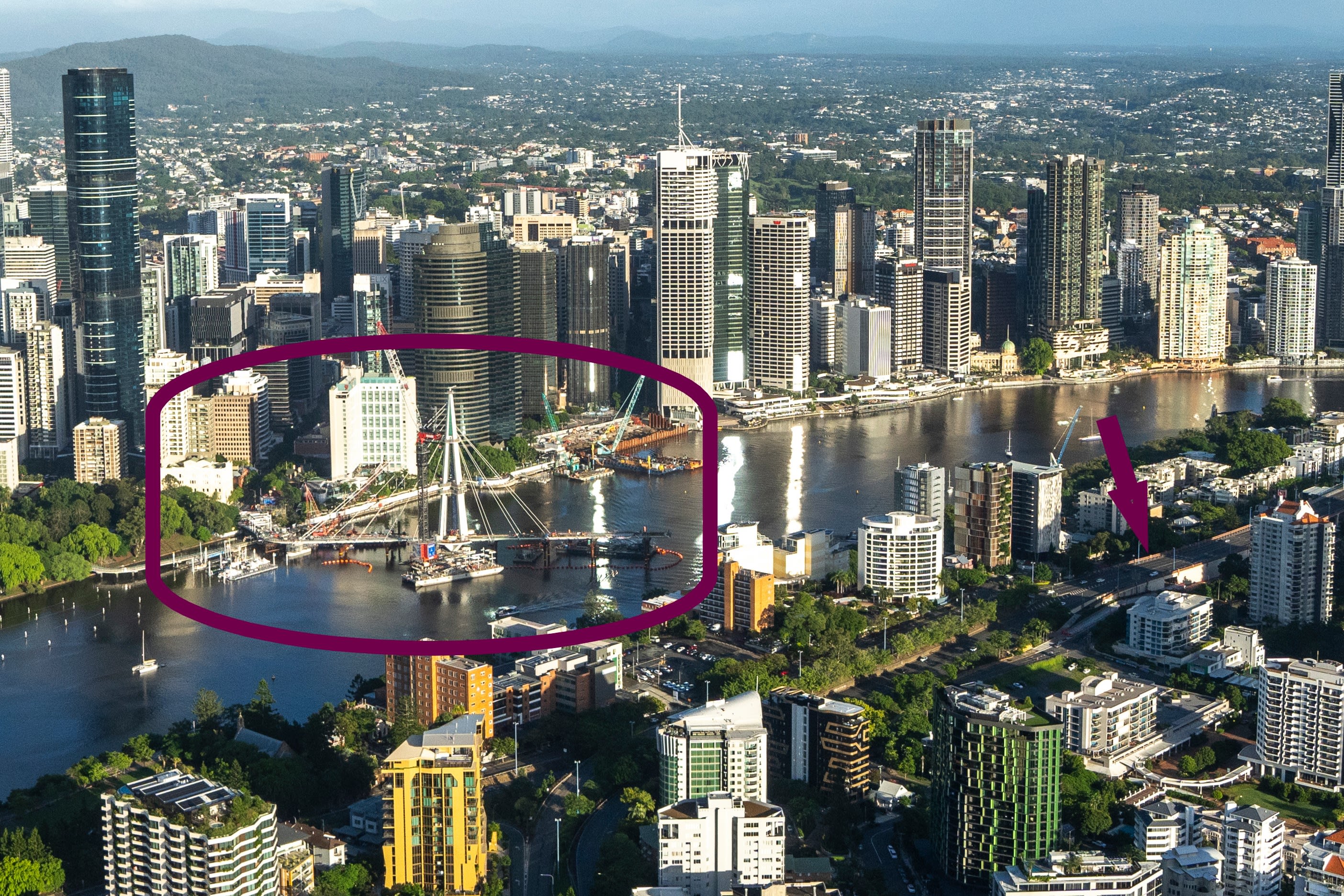
Pedestrian bridge (circled) under construction, left. The monitoring site (arrow) is to the right.
Opened in 1940, the steel cantilever bridge spans the Brisbane River, carrying cars, bicycles and pedestrians between the northern and southern suburbs of Brisbane. In 2023, a new pedestrian- and cyclist-friendly underpass was created on the south side to facilitate access to the Kangaroo Point Green Bridge.
The project brief
The team at RPS, led by Nick Morey, surveyor and practice leader for the RPS surveyors in Brisbane, was tasked with ensuring Story Bridge’s stability by detecting potential shifts in the columns during construction excavation for the new underpass.
The solution
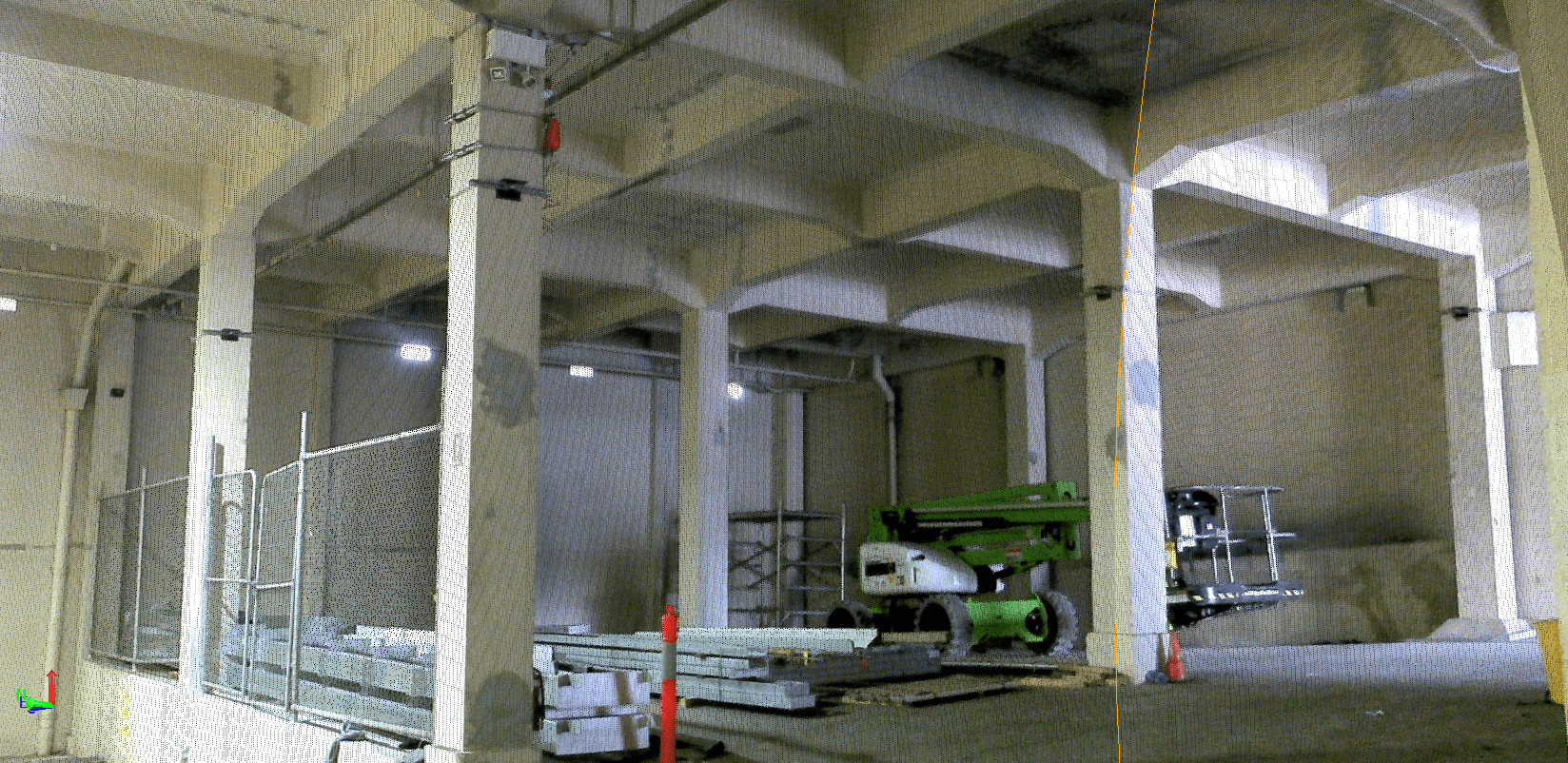
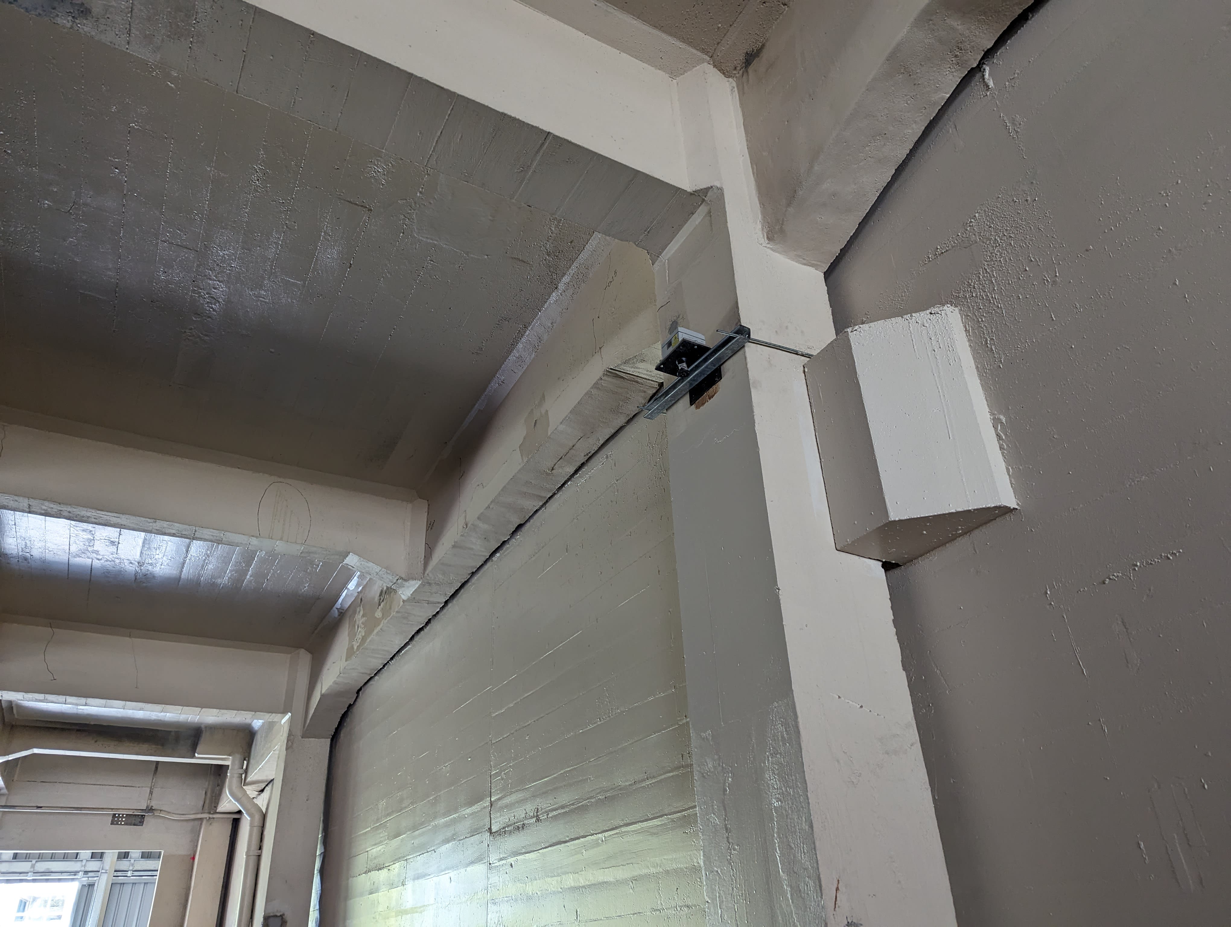
The RPS team, aided by Trimble Authorized Dealer UPG, deployed seven Trimble LaserTilt90 devices on columns throughout the site, focusing on locations that would be sensitive to the excavation. The devices were set to take a measurement each hour, with alerts set if any measurement hit the threshold. Measurements taken from the sensors were sent by an on-site router to Trimble 4D Control (T4D) software, which collected, analyzed and logged the data and controlled the alert system.
Morey emphasized, “As the site was confined to a tight space, the less personnel on-site the better from a safety and logistical perspective. The client was originally looking at traditional total station monitoring once a month, so the tilt sensor solution offered a lot more rigor in their monitoring system”
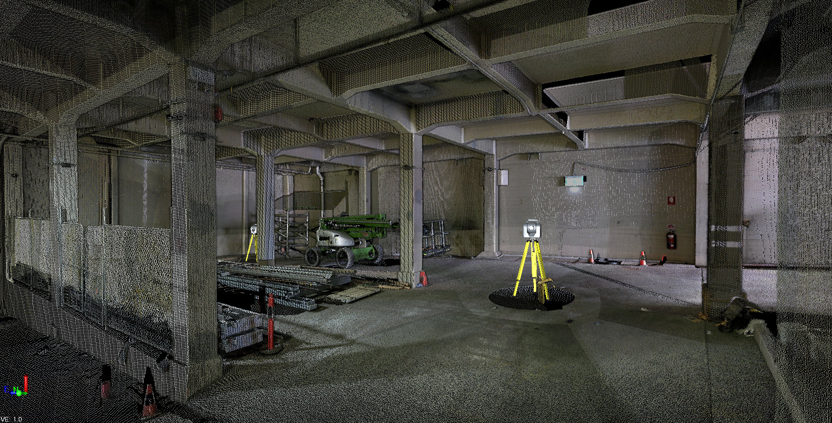
For redundancy in the monitoring network, sensors were placed so that each column had a sensor reading a distance to it, and had the tilt measurements relating to the columns that each sensor was directly attached to. Each unit also had a monitoring prism mounted to the underside of the attachment bracket, allowing manual Trimble SX10 total station measurements. These were taken at the start and throughout the year-long monitoring period.
“If we were just using traditional surveys, we’d have to go back to measuring traditionally to those brackets to ensure that there was a fair bit of redundancy in the measurements,” Morey said. “And we did that periodically through the project, but the tilt sensors that we were using were measuring every hour as the construction ramped up and reported on that through T4D.”
The challenge
In addition to the usual chaos of a construction site, one of the newly constructed concrete walls unexpectedly required temporary struts to be placed on the same columns as the monitoring units. In some cases, these wall supports directly blocked the distance measurements to the original measurement location.
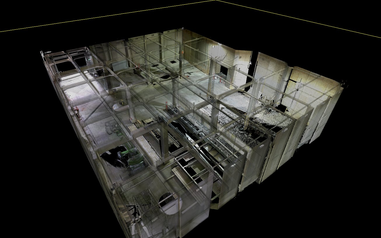
“Thankfully the affected baseline distances were able to be reset within T4D after traditional measurements confirmed that no column shifts had occurred,” Morey said.
The disruption could have been resolved if the brackets were placed a small distance up or down, or if the site staff were made aware of the lasers in place with signage warning not to obstruct. This highlights the essential role construction site communication plays in a remote monitoring project and how every site has different variables to consider.
The results
No shifts in columns were detected during construction. T4D issued alerts several times during construction, but after the site investigation, it was found that all were due to the construction interferences and not due to actual movement.
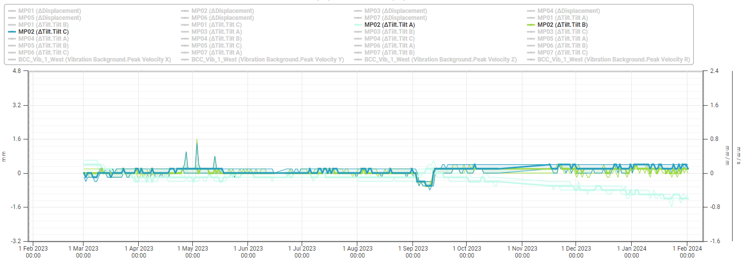
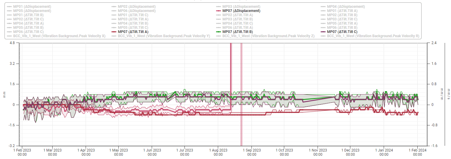
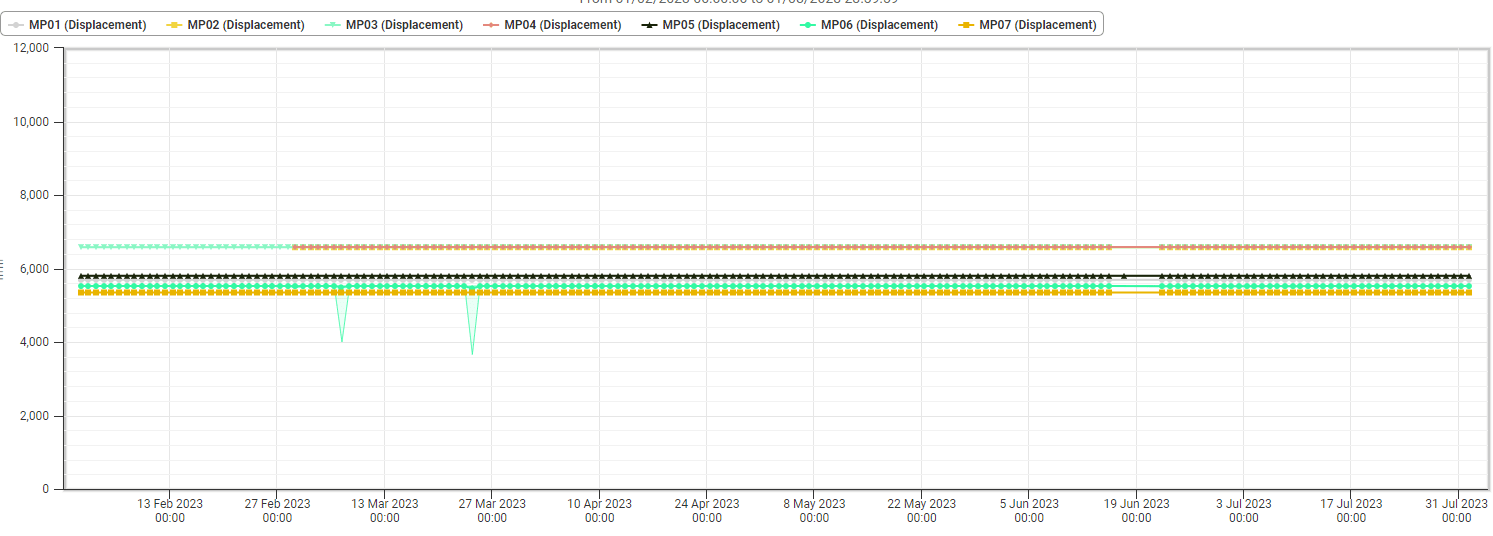
Manual measurements taken at the start and after the site disruptions show that no discrepancies were present, with an average residual of ~1 mm. These tight residuals confirm that the construction activities did not have a measurable impact on the location of the structural columns. Despite issues, the sensor monitoring was effective throughout the project largely due to the many redundancies in place for the system.
“The amount of data that we collected is much more useful for them than the small amount of data that’s collected using traditional techniques, Morey said,” More data is useful in identifying the time and the source of a movement if there is an instance where movement is detected.
He concluded, “We are certainly looking forward to the next project that we can deploy this monitoring equipment on and welcome future collaboration with UPG.”
Learn more about the Trimble geotechnical products and T4D Control office software.