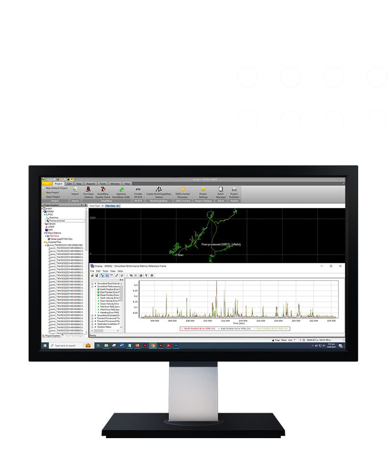
Office software
Applanix POSPac MMS
A start-to-finish workflow for direct georeferencing.
Applanix POSPac® Mobile Mapping office software, with postprocessed Trimble® CenterPoint® RTX, is an industry leading GNSS-aided inertial software for direct georeferencing of data collected from multiple types of sensors on mobile platforms.
![geo-product-applanix-pim-image](http://images.ctfassets.net/1nvkn1423yot/7BjgwvjFmDfvtGKTcGChJF/f716029f0552ed15e39b1c91a66fb684/geo-applanix-productpage-fullbackgroundproducthero-800x960.png)
Features and capabilities
![With a single GNSS base station](https://images.ctfassets.net/1nvkn1423yot/6x4WZpSp0LEsZhjhtHIyul/fe6747c229d52620af5acb5401ccec81/geo-applanix-POSPac-unboundedcard-370x247.jpg?fm=jpg&fl=progressive&w=50&h=50&q=90)
With a single GNSS base station
Easily process trajectories with single or multiple GNSS base stations.
![Obtain cm-level accuracy](https://images.ctfassets.net/1nvkn1423yot/1TmRmNs6Kre7XZCnuQK1Pf/c98b37f66c8cbbf23c29b69206be48e8/geo-applanix-POSPaconPC-unboundedcard-370x247.jpg?fm=jpg&fl=progressive&w=50&h=50&q=90)
Obtain cm-level accuracy
Achieve centimeter-level accuracy without reference stations using postprocessed Trimble CenterPoint RTX data for open sky applications.
![Work online or offline](https://images.ctfassets.net/1nvkn1423yot/1EwRwmn6x1veWqNE09s4S4/c0ed37c3119c3b9c18692064d3eefeea/geo-applanix-POSPaconlaptop-unboundedcard-370x247.jpg?fm=jpg&fl=progressive&w=50&h=50&q=90)
Work online or offline
License checkout capability for offline field jobs support.
![Do more with Trimble technology](https://images.ctfassets.net/1nvkn1423yot/6cDok63QYmIHrvOwt6ZBNx/17375cb1e853fae07f17ba31ee45fed8/geo-applanix-oceanfloor-unboundedcard-370x247.jpg?fm=jpg&fl=progressive&w=50&h=50&q=90)
Do more with Trimble technology
Achieve high accuracy with Applanix SmartBase and IN-Fusion technology.
Product summary
Applanix POSPac MMS
GNSS-aided inertial postprocessing.
Product
Features
Operating System
Windows 10 support
Processor
64-bit processing
License
Floating license support
Automatic base station survey
Static PP-RTX
Office software
Applanix POSPac MMS
Get in touch for recommendations for the Geospatial hardware, software, and accessories needed to get your job done.
Contact us![geo-product-applanix-pim-image](http://images.ctfassets.net/1nvkn1423yot/7BjgwvjFmDfvtGKTcGChJF/f716029f0552ed15e39b1c91a66fb684/geo-applanix-productpage-fullbackgroundproducthero-800x960.png)
Works with...
![Trimble MX9](https://images.ctfassets.net/1nvkn1423yot/2bddyON9tW6RwcwNbBzcCx/83d22f44cbd85eda71e9e415189dca53/geo-mx9-boundedcard-272x181.png?fm=jpg&fl=progressive&w=50&h=50&q=90)
![Trimble MX50](https://images.ctfassets.net/1nvkn1423yot/uYBVMNQ9H3q6TPj97Jgkr/4e877d6c3882b5cfbbbb28f98c2e2759/geo-product-mx50-primary-card-image-272x181.png?fm=jpg&fl=progressive&w=50&h=50&q=90)
![Trimble MX7](https://images.ctfassets.net/1nvkn1423yot/1a3o1RybuurWD2zCAT9XR1/e64c54ee67a2868d665868819610e4cc/geo-mx7-boundedcard-272x181.png?fm=jpg&fl=progressive&w=50&h=50&q=90)
Resources and knowledge
![Go beyond the data](https://images.ctfassets.net/1nvkn1423yot/4mX4IpJlmBszW56JXH5aLK/0a700f82280884a97795cdbad4db3fa4/geo-resources-boundedcard1-272x181.jpg?fm=jpg&fl=progressive&w=50&h=50&q=90)
![Inspiring perspectives](https://images.ctfassets.net/1nvkn1423yot/MAOHEc7pfrLCwSYlQWkXa/7823dd85d95b50707428c20fb742bd05/geo-resources-boundedcard2-272x181.jpg?fm=jpg&fl=progressive&w=50&h=50&q=90)
Inspiring perspectives
![Watch what Trimble can do](https://images.ctfassets.net/1nvkn1423yot/6TQWqFBh7v3AzZb70t5D1S/cd9109d57466b367ab07b648290dcaea/geo-trimblex9-productpage-keyfeatures-720x720.jpg?fm=jpg&fl=progressive&w=50&h=50&q=90)
Watch what Trimble can do
![Join us live or later](https://images.ctfassets.net/1nvkn1423yot/7aooMSiWnw5vE8w3c0pv6t/3f1c64a3208dec908d5de204b7df4e2a/geo-resources-boundedcard4-272x181.jpg?fm=jpg&fl=progressive&w=50&h=50&q=90)
Join us live or later
Want to learn more?
Contact Trimble Geospatial today.