Field software
Trimble TerraFlex
Streamline your data collection.
Unite easy, intuitive field data capture with high-accuracy GNSS positioning with Trimble® TerraFlex® software for a single, streamlined solution. Whether it's time to modernize or you're starting from scratch, TerraFlex checks all the boxes.
Benefits
Streamline your field operations
Utilize cloud data sync for streamlined deployment and management of larger projects, or keep it local and create, capture, and share directly from your device.

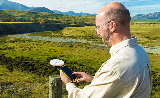
Accuracy, here, there and anywhere
You capture it, we correct it. Utilize the range of high-accuracy GNSS solutions from Trimble and get the precision you demand no matter where the job takes you.

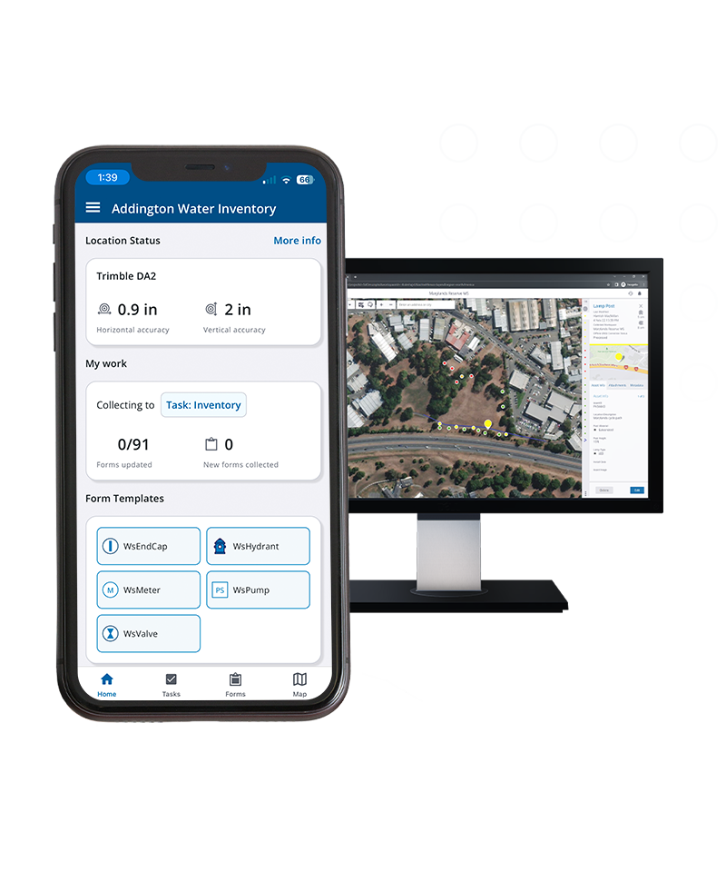
Trimble TerraFlex
How it works
Streamline data collection projects and simplify their deployment across your entire organization.
Features and capabilities

Trimble GNSS Correction Technology
Combine our real-time and offline GNSS correction technology to capture accurate data in any environment.

Trimble Catalyst
Deploy Trimble Catalyst™ positioning service for scalable accuracy, and combine with TerraFlex for a precision-enabled field data capture workflow.

External sensor integration
Calculate offsets and store measurements directly to your TerraFlex forms. Reduce data entry errors and improve field efficiency with external sensors.

Designed for peak field performance
Our latest update introduces a modern, simplified experience that perfectly aligns with your data capture and inspection workflows.

Industries and applications
The future of your work.
Trimble solutions facilitate high-quality, productive workflows and data exchange, driving value for a global, diverse user base.
Product summary
Trimble TerraFlex
Cloud-based solution for streamlined field data capture.
Product
Features
Customizable form templates
Easy-to-use template builder
Cloud synchronization
Efficient data flow from the field
Offline GNSS corrections
Automated GNSS post-processing
Remote feature capture
Simplified laser offset workflow
Update and maintain data
Import and update existing data
Data collaboration
Export and share captured data

Affordable
Enable your whole team to use TerraFlex
Flexible
Monthly or annual
Up-to-date
Automatic access to new updates
Field software
Trimble TerraFlex
Get in touch for recommendations for the Trimble Geospatial hardware, software, and accessories needed to get your job done.
Where to buyWorks with...


Trimble Business Center GIS
TBC GIS integrates survey and GIS data, enabling seamless data exchange and efficient workflows.


Resources and knowledge


Watch what Trimble can do


Deepen your knowledge
Read customer success stories, study ebooks and white papers, and more.

Next steps
Our global network of Distribution Partners provides precision geospatial solutions, insight and support at a local level.